Preparing for the Next Blizzard
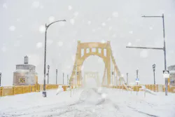
Snow remains a major topic for state transportation departments long after it melts, and the summer months provide agencies time to develop their maintenance plans for the upcoming winter. After the unprecedented snowfall of early 2026, when many northeastern departments of transportation overspent their snow removal budgets, there is mounting pressure to improve accuracy and efficiency in response efforts.
For agencies such as the Allegheny County Department of Public Works, winter preparation begins long before the first snowfall. The western Pennsylvania county, which includes Pittsburgh and many of its suburbs, starts winter maintenance preparation in August, when trucks are outfitted with plows and spreaders and crews inspect equipment, evaluate staffing levels and review lessons learned from the previous season. Officials also assess material inventories and operational performance to identify areas for improvement before winter arrives.
As technology continues to play a growing role in daily transportation decisions, agencies have access to more detailed weather and roadway data than ever before. That information is helping maintenance teams make more informed decisions before and during winter storms.
Rather than reacting solely to snowfall totals, agencies are increasingly monitoring factors such as pavement temperatures, precipitation type and forecast conditions to determine when crews should be deployed and what treatments may be needed.
These considerations are leading transportation departments to reevaluate whether traditional snow measurement tools are enough or if more comprehensive, connected systems are needed.
To run data-informed operations, DOTs are electing to install snow-depth sensors incrementally—a more cost-effective approach—or invest in full Road Weather Information Systems (RWIS) and Maintenance Decision Support Systems (MDSS) platforms that provide a more complete picture of weather conditions.
The Technology Toolkit
Transportation agencies have access to a growing range of technologies to monitor winter weather and roadway conditions. While traditional ultrasonic snow-depth sensors remain widely used because of their cost and compatibility with existing systems, some agencies are beginning to evaluate newer LiDAR-based alternatives that can provide more reliable measurements during active snowfall.
R.M. Young’s SNOdar sensor uses LiDAR technology to maintain snow-depth measurements during storms, when accurate information is most critical. Unlike ultrasonic sensors, which can be affected by blowing snow and other atmospheric conditions, LiDAR uses a narrower beam to focus on the snow surface itself.
“Based on that, it’s going to see fewer of the snowflakes because it’s covering less of the air volume,” said Conor Byrne, engineering manager at R.M. Young. “Really, all of your signal that’s coming back to the sensor is coming from the snow surface.”
But snow-depth measurements are only one piece of the winter maintenance equation. Agencies increasingly rely on broader networks of weather stations, pavement sensors and forecasting tools to monitor conditions in real time and support operational decision-making.
“None of it happens alone, especially as it comes to roads and bridges,” Byrne said. “No one data point, no one sensor tells you everything.”
RWIS combine data from weather stations and pavement sensors to monitor roadway and atmospheric conditions in real time. MDSS build on that information by incorporating weather forecasts and recommending operational responses, such as when to deploy crews or apply chemicals.
As a result, many agencies are weighing whether to add individual sensors incrementally or invest in more comprehensive road weather information systems and maintenance decision-support platforms that combine weather observations, pavement conditions and forecasting data into a single operational view.
From Data to Decisions
For many agencies, the goal is not simply collecting more data but understanding how that information should influence operational decisions.
The Minnesota Department of Transportation (MnDOT) operates 160 weather stations statewide. MnDOT’s weather stations collect far more than snowfall measurements. The network gathers information on pavement temperatures, wind conditions, road-surface conditions and other environmental factors, giving maintenance managers a more complete picture of how a storm is affecting the roadway.
While snow depth remains useful information, MnDOT officials said pavement temperatures, precipitation type and forecast conditions often play a larger role in operational decisions because they help crews determine how roads will be affected and what response may be needed.
“We are out there as snow begins to fall,” said Jed Falgren, MnDOT’s state maintenance engineer. “We are trying to be out there and begin making sure that we don’t get snow accumulations, or if we get them, we can at least manage them a little bit better.”
Pavement-temperature sensing has become a major focus for the agency. While snowfall totals remain useful, officials said roadway temperatures often provide more actionable information because they determine whether precipitation will freeze on the pavement.
“The air temperature is one thing, but snow and ice really cares what it’s in contact with,” Falgren said. “So, we really are concerned about instrumentation, understanding what pavement temperatures are. If there is any single data point that is far more important to us than the depth of snow.”
Allegheny County officials echoed that perspective. Brent Wasko, public information officer for the Allegheny County Department of Public Works, said advances in forecasting tools have given agencies access to more precise and localized weather information. The county uses a WeatherSentry service, which is run by DTN, that provides staff with the ability to consult directly with meteorologists to better understand how storms will affect specific roadways and when pavement temperatures are expected to fall below freezing. That information allows crews to adjust staffing and response plans before conditions deteriorate.
“A lot of times we have the issue with the pavement temperatures where it’ll be above freezing for a period of time during the storm and then fall below it,” Wasko said.
Knowing when those temperature changes are expected to occur helps the county determine when to deploy crews and what treatments may be needed.
RWIS sensors support MnDOT’s team in making systemic decisions such as whether to apply chemicals, whether plowing is needed and how to best manage the resources at their disposal.
“We want to understand what is happening out there, and then what should our response be,” Falgren said, in order to keep the roads open throughout the storm.
Their system also helps crews use resources more efficiently. In blowing snow conditions, Falgren said, wind may clear snow from the roadway on its own, reducing or even eliminating the need for plowing.
In recent years, MnDOT has continued expanding its weather-monitoring network, adding dozens of additional sensors to provide more real-time information to decision makers.
For smaller and mid-sized agencies, forecasting and fleet-management tools can play just as important a role as roadway sensors. Allegheny County relies heavily on WeatherSentry to monitor storm timing and anticipated roadway conditions. The county also uses Geotab vehicle-tracking technology to monitor fleet locations and verify where trucks have plowed or applied salt.
Accurate forecasting can directly influence staffing decisions. If forecasts indicate snow will begin several hours before a scheduled shift, Allegheny County officials may bring crews in early so operators are already on the road when conditions begin deteriorating.
“If they’re saying it’s going to come around 2 a.m., and we normally start at 4 a.m., I will bring that crew in at midnight,” said Jim Castelluci, the assistant deputy director of maintenance for the Allegheny County of Public Works.
In addition to the forecast, the county also considers pavement temperatures and snow and ice conditions to determine their best course of action.
“If we know we have ice conditions, we will throw down liquid calcium mixed with our salt,” Castelluci said. “If we are getting more snow than normal, we will bring more drivers in.”
Agencies continue to evaluate new technologies as they prepare for future winters, including the one that is right around the corner. Allegheny County officials are currently exploring additional weather-monitoring and road-condition technologies after observing implementations by neighboring municipalities.
About the Author
 Jessica Parks, Staff Writer
Jessica Parks, Staff Writer
Staff Writer
Jessica Parks is a staff writer at Roads & Bridges with newsroom experience in Brooklyn, Long Island and the U.S. Virgin Islands, and several years spent living in Puerto Rico. She is currently based in Tulsa, Oklahoma.