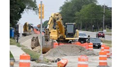
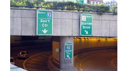
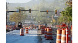
Beginning in June 2010, the Chicago Department of Transportation’s (CDOT) Division of Engineering began the reconstruction of the Wacker Drive interchange with Congress Parkway.
The project, estimated at $75 million, will reconstruct all roads, tunnels and landscaping, as well as replace or relocate all public and private utilities in the interchange area. This project is scheduled to be completed by mid-2012. As the prime consultant selected by CDOT for design of this complex interchange, T.Y. Lin International’s role encompassed not only the technical engineering design of the interchange, but also numerous other facets of the project. These included re-analysis of many preliminary engineering elements, coordination with adjacent concurrent construction projects, coordination with numerous private and public utility companies and agencies, and coordination with multiple local, state and federal entities and agencies.
Moving north-south
Wacker Drive is a two-way, two-level roadway that connects Congress Parkway at the south/west end to Lake Shore Drive on the north/east end. The roadway structure is located within the city of Chicago, bounding the west and north sides of the central business district.
In 2002, reconstruction of Wacker Drive from Michigan Avenue to Randolph Street, commonly referred to as the east-west segment, was completed. This project included increased lane widths; increased vertical clearance for lower Wacker Drive; new roadway lighting; improved landscaping; it created space for the Chicago Riverwalk; and it restored historic limestone elements. However, this was but the first phase of what was intended as the reconstruction of the total length of Wacker Drive.
Although design for the remainder of Wacker Drive, from Randolph Street to Harrison Street, commonly referred to as the north-south segment, including the interchange with Congress Parkway, was started in mid-2000, the lack of construction funding precluded finalizing the design and constructing the north-south section. In 2009, design was resumed for the north-south segment and the Congress Parkway interchange upon the obtainment of construction funds, with the goal of beginning construction in 2010. The reconstruction of north-south Wacker Drive will pick up where the east-west construction left off, completing the improvements for the full length of Wacker Drive.
Appealing to Congress
Wacker Drive has been a major roadway in the heart of Chicago’s downtown area for more than 80 years. In Daniel Burnham’s original plan of 1909 for the city of Chicago, Wacker Drive was designed with a distinct purpose. The upper-level roadway was to be a grand boulevard for pedestrians and passenger cars with elaborate architectural enhancements. The lower-level roadway was designed to be a utilitarian interface between the Chicago River and commercial vehicles. Dock space was created so that deliveries could be made to the buildings located along Wacker Drive.
The east-west section of Wacker Drive, from Michigan Avenue to Lake Street, was constructed in the 1920s, while the north-south section, from Lake Street to Harrison Street (including the interchange with Congress Parkway) was constructed in the 1950s in conjunction with construction of the Eisenhower Expressway.
Since the construction of Wacker Drive, the use of the Chicago River has changed dramatically. Deliveries from large commercial vessels has all but disappeared, replaced by deliveries to the buildings now performed by trucks on the lower level. Additionally, the area surrounding Congress Parkway has been one of the fastest growing employment, residential and commercial areas in the city. These changes have altered travel patterns and significantly increased the amount of pedestrian and vehicular traffic in the area. Approximately 60,000 vehicles travel daily on the upper and lower levels, many using the interchange with Congress Parkway as the means of ingress/egress.
The interchange with Congress Parkway is a major element of the function of Wacker Drive. The Eisenhower Expressway to Congress Parkway serves as a direct connection from the western suburbs to the city. Commuters and tourists utilize this interchange as the main route of access to their places of work, recreation and cultural attractions. This interchange also is a vital link for delivery vehicles to access to/from lower Wacker Drive, the numerous buildings located along this roadway, and other delivery points within the city.
However, the existing interchange is currently a potpourri of poor geometrics, inadequate lighting levels, poor structural conditions, unused green space and an aesthetic eyesore to those entering through this gateway. Utilizing the interchange is not for the faint of heart, though daily users have learned how to navigate the roadway system. A conundrum of challenging decision points make this interchange a white-knuckle adventure ride to those unfamiliar with the roadway system.
From eastbound Congress Parkway, access to Wacker Drive and Franklin Street is provided via two ramps located west of Wells Street. The split between the two ramps occurs in the ramp curve immediately upon exiting Congress Parkway, forcing motorists to make a split-second decision regarding their roadway selection. The ramp continuing to Wacker Drive then enters into a poorly lit tunnel under Franklin Street, before daylighting and splitting to the upper and lower levels immediately after passing under Congress Parkway. Traveling southbound on upper Wacker Drive, access to Congress Parkway is via the local surface streets. Accessing westbound Congress Parkway from southbound lower Wacker Drive is done via a one-way tunnel/ramp connecting directly to Congress Parkway. Traffic utilizing this tunnel travels along a roadway partially covered and partially open from above, creating a continuous flux between natural light and darkly lit tunnel sections. In addition, there also is a ramp from northbound Franklin Street to westbound Congress Parkway, which parallels the ramp from lower Wacker Drive before merging, ending in a stop-sign-controlled entrance to westbound Congress. A merging lane on Congress Parkway is not provided for this movement, creating a challenge for motorists.
Aesthetically, the large amount of available green space covering the roadway tunnels is largely unused. Access to these areas of green space is difficult, and is not an inviting or user-friendly space. What should serve as a gateway entry into the city of Chicago is currently tracts of land largely invisible to motorists entering the city and is uninviting and inaccessible.
Better function, deeper green
Based on the existing operational, safety and structural problems, which need to be addressed, CDOT has two major goals for this project: improve the functional operation of the interchange and provide additional green space in the interchange area. To accomplish these goals, complete reconstruction of the interchange is required.
Operationally, a complete geometric redesign of the existing interchange configuration was performed. The proximity of the interchange area to the Chicago River to the west, buildings to the north, Wells Street to the east and Harrison Street to the south required that the roadway geometrics be confined within this defined boundary. Key improvements to the reconstructed interchange will include:
- Improved roadway horizontal curvature and vertical clearance; New interchange roadways and ramps, including post-tensioned ramps and tunnel roof slabs;
- New enclosed tunnel structure with ventilation fans from southbound lower Wacker Drive to westbound Congress Parkway; New enclosed tunnel structure from eastbound Congress Parkway to Wacker Drive and Franklin Street;
- Relocation of the eastbound Congress Parkway exit split between Wacker Drive and Franklin Street to the intersection of these two roadways in order to provide motorists more time to make their route decision;
- New tunnel and roadway lighting including transitional lighting into and out of the roadway tunnels;
- Elimination of the ramp from northbound Franklin Street to westbound Congress Parkway;
- Addition of an acceleration lane on Congress Parkway for vehicles traveling from lower Wacker Drive; and
- Widening of Congress Parkway to allow for acceleration/deceleration lanes.
-
In order to maximize the amount of green space in the interchange area, the roadway tunnels were covered as much as possible, combined with raising the grade of the interchange area to more closely match the level of Congress Parkway. By covering the tunnels, additional green space was gained. In addition, a new landscaping plan was created with the intent of making the interchange a gateway into the city. This newly gained and relandscaped park area also has been designed to encourage passive use of the area through the use of access paths and relatively flat lawn areas.
Group of four
By itself, the magnitude of the interchange reconstruction will have major impacts to area vehicular and pedestrian traffic, as well as residents and businesses. However, to compound the impacts, the construction of the Wacker Drive interchange will occur concurrently with three other adjacent projects: the Illinois Department of Transportation’s rehabilitation of the Congress Bascule Bridge over the Chicago River, CDOT’s reconstruction of Congress Parkway from Wells Street east to Michigan Avenue, and CDOT’s reconstruction of the north-south Wacker Drive viaduct from Van Buren Street to Randolph Street. Due to the urban setting of this large-scale project, extensive coordination was required with local aldermen, building owners, public and private utilities, and various city, state and federal agencies. A major challenge to managing the impacts was how to maintain vehicular and pedestrian traffic through and around the area surrounding these various projects. To solve this predicament, an overall area traffic-management plan was developed, which took into account the adjacent projects and their individual construction staging schedules. In order to accomplish this, coordination between CDOT, IDOT and various city agencies was a key element. The result of this coordination was development of an overall traffic-management plan that includes the designation of detour and alternative routes, and signal-timing changes, pavement-marking revisions and signing revisions to the intersections along the detour and alternative routes.
The spider web of numerous private and public utilities within the interchange area also has proven to be a big challenge to this project. Due to the complete reconstruction of the interchange, virtually every existing utility is being impacted, requiring relocation. While public utilities including sewer and water are included as part of the design of the improvements, the relocation of private utilities must be performed by the owning company.
The relocation of the private utilities is further complicated by the limited amount of space below the roadways bounding the project area—space currently occupied by public and private utilities, or planned to be occupied by public utilities as part of the reconstruction. Based on the number of utilities and the limited available space, an overall master plan was developed, designating corridors for each of the utility companies. In addition, weekly coordination meetings were held with all public and private utility owners to work out issues and monitor the relocation process. This method was extremely successful in getting all private utility relocation work completed before the start of the interchange reconstruction.
The underground construction of the new foundation elements, the roadway tunnels and utility relocations present perhaps the largest unknown to this project. When the interchange was originally constructed, there were numerous buildings located within the footprint of the interchange. Based on review of the original 1950s plans, it appears that the foundation elements for these buildings were left in place, and it is anticipated that the demolished buildings themselves were used as fill material. While the design plans depict the foundation elements as shown in the original plans, it remains unknown as to whether all or some of these foundation elements are still in place, and whether the demolished building materials are part of the fill material. Although the geotechnical borings did encounter some underground obstructions, the extent, frequency, depth and composition of these obstructions are not known, and will remain so until excavation of the interchange begins.
Grand opening
The combined improvements of roadway alignment, lighting and structures with the new landscaping will provide a grand gateway entrance into the city of Chicago. When completed in 2012, the new interchange between two major roadways in Chicago will be an enormous enhancement to motorists, tourists, pedestrians, businesses and residents in the area.


