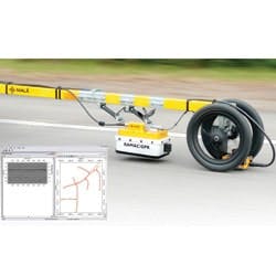
Mala recently released an FCC-approved high-speed, multi-channel GPR system for use in roadway evaluations, revolutionizing the collection of radar data to determine asphalt, base and sub-base thicknesses.
The system features a new software package designed to facilitate file management of collected roadway data based on GPS positioning. The RoadMapper program allows the user to define points of reference for selecting sections of the road that are of specific interest from the already-collected data for post-processing. These points of reference can be placed in the field while actually collecting the data, chosen by the user by utilizing the graphic interface or by manually typing in the actual GPS coordinates.
