How Technology Is Reshaping Roadway Safety and Traffic Management
Key Takeaways
- AI-powered platforms are helping agencies detect incidents faster and identify high-risk locations before crashes occur.
- Connected technologies — from smart signals to dashcams — are improving traffic flow and driver safety in real time.
- Transportation agencies are increasingly turning to data and automation to address workforce shortages and modernize operations.
Technology is playing a major role in roadway safety, with a growing range of solutions addressing issues across the transportation network. Roads & Bridges is rounding up digital platforms that can benefit all roadway users — alerting drivers to potential collisions, informing DOTs of high-risk intersections and even predicting potential avalanches.
As the roads and bridge construction industry faces ongoing workforce shortages, companies and transportation agencies are increasingly looking for ways to work smarter through technology.
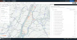
AI Detects Real-Time Traffic Hazards
The North Carolina Turnpike Authority (NCTA) is launching a pilot project on Interstate 485’s express lanes in partnership with Valerann’s Lanternn platform, an AI-enabled cloud platform designed to improve response times to roadway incidents.
Using NCTA’s network of traffic cameras, navigation platforms and third-party sources, Lanternn analyzes real-time traffic conditions to detect hazards such as wrong-way drivers, crashes, stopped vehicles and pedestrians in the roadway.
When incidents are detected, the platform alerts operators, enabling faster response times. The system also reduces the need for continuous camera monitoring, allowing operators to manage multiple feeds more efficiently.
Using Data to Identify High-Risk Intersections
Cambridge Mobile Telematics (CMT)’s StreetVision platform combines crash outcomes with behavioral risk metrics to identify intersections with elevated crash risk.
By analyzing driving behaviors such as hard braking, speeding and phone distraction alongside crash data, the platform helps DOTs address high-risk locations before incidents occur.
StreetVision uses AI to rank dangerous intersections and flag emerging safety concerns, giving agencies better data to guide infrastructure investments and improve roadway safety outcomes.
AI Dashcams Improve Driver Safety – Fast Company
Collisions are becoming even more common as driver distraction increases. Motive is working to address this with AI-powered dashcams that not only record incidents but actively help prevent them, according to reporting from Fast Company.
The system detects unsafe driving behaviors such as lane swerving, distracted driving and tailgating, alerting drivers before the crash occurs. Using stereo vision and dual forward-facing lenses, the technology improves accuracy when measuring distance and closing speed — enhancing alerts for read-end and sideswipe risks.
Nashville Deploys Smart Signals to Reduce Congestion– The Nashville Tennessean
As Nashville continues to rank among more congested U.S. cities, local officials are turning to signal technology to improve traffic flow, according to reporting from The Nashville Tennessean.
The Nashville Department of Transportation and Multimodal Infrastructure partnered with WeGo to deploy transit signal priority technology at 27 intersections along Charlotte Avenue.
The system adjust signals in real time —extending green lights, shortening red lights and giving buses priority when needed. Early results show a 3-5% reduction in bus travel times and an 18-19% decrease in time spent waiting at red lights.
Officials are exploring expansions to other corridors, including Murfreesboro Pile, where signals will adapt dynamically based on traffic volumes.
Alaska Uses Sensors to Predict Avalanches - Governing
In Alaska, transportation officials are using sensor technology to predict avalanches before they impact roadways, according to Governing.
Sensors placed in high-risk zones detect infrasound — low-frequency sound waves — to identify avalanche activity and send alerts to smartphones. While infrasound has long been used to monitor earthquakes and volcanic activity, its use in avalanche detection is still emerging.
Combined with weather data, the system allows the Alaska Department of Transportation to proactively respond — either by clearing routes more efficiently or closing roads before an event occurs.
The technology also improves worker safety by allowing crews to monitor conditions remotely, reducing exposure to hazardous environments.
About the Author

Jessica Parks, Staff Writer
Staff Writer
Jessica Parks is a staff writer at Roads & Bridges with newsroom experience in Brooklyn, Long Island and the U.S. Virgin Islands, and several years spent living in Puerto Rico. She is currently based in Massachusetts.