Evolving GIS-Centric Asset Management Solutions
With federal mandates and funding incentives through initiatives such as the Infrastructure Investment and Jobs Act and Moving Ahead for Progress in the 21st Century Act, state transportation agencies are adopting digital solutions for asset lifecycle management.
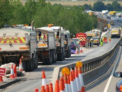
The growing trend in deployment of Geographic Information Systems (GIS)-centric resources drives productivity, reduces risk and lowers total asset costs across the entire asset lifecycle – from planning, design and construction through operations and maintenance.
Digitized capital planning tools automate processes for accuracy, efficiency and transparency. Building Information Modeling and digital twin delivery systems create paperless, collaborative workflows with open data to eliminate data silos, decrease errors and reduce costly project change orders.
Accessible, digitally driven dashboards make data immediately visible, enabling operational transparency and more cost-effective preventative maintenance efforts.
As artificial intelligence (AI) and virtual reality technology evolves, it is clear that the digital transformation of America’s infrastructure industry will continue to progress.
Roads & Bridges spoke to a couple of innovative transportation leaders to get first-hand perspectives on how digital asset management solutions are becoming integral elements of their infrastructure management strategies.
Below are highlights from conversations with Mike Rossi, chief data officer for the New York State Department of Transportation, and Thomas Zimmerman, planning director and asset management business process specialist for the Minnesota Department of Transportation.
Question: What are a few of the most pressing challenges your DOT is currently facing with regards to asset management?
Mike Rossi: Like a lot of DOTs, completing the asset data cycle has been a real challenge. We get excellent data from our annual or biannual inventory collection activities, but how do we collect data in the "off years" between collections? Or how do we capture underground assets or utilities that can’t be visually collected in a consistent manner? We’re currently exploring methods to pull data from our design and as-built drawings and import that data into our asset management systems.
Thomas Zimmerman: Although there are many challenges that we face with regards to asset management, I would say the most pressing challenges are trying to keep our asset inventories up to date as well as remaining as nimble as we can with the ever-changing technologies that are being introduced. We have very large datasets of inventory and when new ways of data collection become available, trying to fit our current inventories into new formats can be very challenging. Additionally, updating our asset inventories when new construction has taken place has always been an issue of timeliness.
Q: What innovative technologies recently have been implemented, or are in the planning phase, at your agency to enhance asset management?
MR: We aren’t doing anything innovative in the technology sphere, per-se, but we are looking at incorporating different aspects of benefits in our basic cost/benefit calculations when assessing projects and programs. The most basic benefit would include the improvement to asset condition, (the classic “area under the curve analysis”). But we’ve included other factors, such as the affected traffic volume and vehicle mix associated with the asset and the major societal destinations (hospitals, fire stations, major economic generators, etc.) around the asset.
We’re currently looking at corridor criticality as well. We’re also looking at synthesizing the “ancillary” asset conditions within a project area to modify the recommended treatment from the Agile Assets software. This could be as simple as pushing a preservation treatment up to something more substantial if the culverts in the corridor need replacement. Synthesizing the conditions and factors around all of the assets in a corridor will help us make better recommendations.
TZ: A recent innovation that will soon be implemented is the automated condition rating for signal poles, lighting units and earth retaining systems. As staff go out and conduct field inspections, the data recorded is uploaded into our Asset Management system and then, through an automated procedure. By leveraging inspection history and element-level ratings, we can now automatically calculate overall asset condition.
Q: Are you integrating AI technology into asset management efforts?
MR: Not at this time. We are taking a “go slow” approach to AI implementation. There are lots of good applications that we can readily deploy around AI to handle mundane tasks, such as document scraping, detection AI in videos and images, etc. But for some other DOT areas we really need to do a thorough review of the legal and security issues involved, especially around AI solutions that interface directly with the public. We are a big proponent of keeping a “human in the loop” on any AI implementations, and that would hold for asset management as well.
TZ: Our focus at this point is to get our data completed at asset level and operational level. We believe our data is close to being good enough for AI. However, we haven't incorporated a lot of AI into our asset management efforts, but with the changing technologies, this will become increasingly used as a tool to analyze and compile large datasets. One example of using AI/machine learning is our SAR-C Project. Quite simply explained, we are using satellite imagery to get condition data for ancillary pavements and sidewalks.
Q: How is your DOT integrating various data sources to gain a more comprehensive view of asset health?
MR: We’re incorporating multiple asset datasets together into a single environment. This information resides in our geospatial data warehouse, and it gets exposed through a series of internal viewers that allow staff to look at data from disparate systems around a given topic. So, for example, our pavement viewer includes condition history from our pavement management system, the last five years of maintenance work orders from our maintenance management system and any future capital projects from program management system, traffic volumes from our traffic data system, etc. Before, staff contacted five or six internal bureaus in to get this info. Now it’s all in one place.
TZ: We have an enterprise asset management system in place and, because of that, we have the ability to understand and analyze the various combinations of assets from a systematic viewpoint for the purpose of planning and programming. We also incorporate programmed projects into our system so maintenance can look at different possible actions based on the timing of future projects.
Q: How are these new technologies influencing your maintenance and rehabilitation strategies?
MR: It hasn’t affected our maintenance and asset management strategies directly, but the greater availability of information has allowed us to make more informed project decisions, especially early on in the design process.
TZ: For many of our asset inventories, we have incorporated an inspection program where the data is captured through field observations or through data imported from our as-built program. The data is then used to create our preventative maintenance reports that are used to make sure we are keeping up on our inspections and necessary maintenance as needed.
Q: What metrics are you using to measure success and return-on-investment for these technological adoptions?
MR: This is still a work in progress, but we’ve seen more efficient asset condition outcomes since adopting an asset management first philosophy in the middle 2010s. Our next step is to track associated metrics, such as the reduction in major cost overruns in the field due to unforeseen circumstances, or a reduction in change orders in the field. In the end, our job is to get the most accurate and thorough information into the hands of our planners and engineers so that they have all the information and tools they need.
TZ: We have many different measures that are used to determine our progress or achievements towards our department goals. For hydraulic assets, for example, our inspection program requires different inspection cycles based on the most recent condition rating of a pipe. We regularly review these inspection reports to make sure that we are completing the inspections and, more importantly, making the necessary repairs to pipes when deficiencies are found to bring their condition rating up to an acceptable level.
Q: How have you used digital solutions to manage mobile work and sync field-to-office and office-to-field communications?
MR: We’ve done a lot of work in this area, mostly within the maintenance management space. Our Agile MMS works directly on a tablet where our highway maintenance crews can report and log their work accomplishments against the existing inventory. They can also record the labor, materials and equipment used as they’re completing the work, making reporting more seamless and accurate. We’ve also deployed a similar solution to our signals crew, so that they can log other important information, such as arrival time on the scene, equipment check-in/check-out, and warranty information. This info gets recorded back into our agile assets system and can be referenced by other users in almost real time.
TZ: We currently use Work Manager, which is a mobile application that is designed with the ability to create and edit work requests and work orders, to add and edit many of our asset types and classes that we have in our asset management system. And we have used it extensively for the purpose of doing field inspections for many asset classes.
Q: Looking ahead, what do you see as the future trends in asset management technologies for DOTs?
MR: Besides the need to “close the asset data loop” I think there is some fertile work to be done in the realms of real time condition collection with sensors, especially in regard to asset maintenance and storm response.
TZ: With things like AI/machine learning, LiDAR data collection and many other emerging technologies that are able to more quickly and accurately collect detailed information of those assets, located along our highway system, I believe that DOTs will be able to better understand, at a higher level of confidence, the current condition of their systems and possibly utilize AI to assist in faster and more comprehensive analysis of this data.