Strong signal
A 2013 AASHTO report on connected vehicle systems stated, “The fundamental premise of the Connected Vehicle Environment lies in the power of wireless connectivity among vehicles, the infrastructure, and mobile devices to bring about transformative changes in highway safety, mobility, and in the environmental impacts of the transportation system.” An extensive test deployment in Michigan, known as the Connected Vehicle Safety Pilot Program, concluded that 81% of unimpaired vehicle crashes could be mitigated with these technologies. As a first move toward realizing some of those significant benefits, the Utah Department of Transportation (UDOT) has recently completed a connected vehicle corridor in the Salt Lake Valley. Since the data on this corridor is being actively used in daily operations of a transit fleet, this may be the first fully operational vehicle-to-infrastructure (V2I) deployment of its type in the U.S.
In order to provide rapid transmission of frequent data packages, the U.S. DOT has focused on Dedicated Short Range Communication (DSRC) radios, operating on the 5.9GHz band, for connected vehicle applications and has tested them extensively over the past 10 years. These radios have a minimum range of 300 meters. The “several millisecond” latency enables use in time-critical applications, such as crash avoidance. No other technology currently has that capability, although the next generation of cellular service (5G) promises to meet those stringent criteria in the next decade. Since most transportation agencies are focused on reducing the loss of life on their highways, and DSRC technology has been proven to mitigate crashes, agencies like UDOT have decided to move forward with available technology today to enhance safety.
Getting progressive
UDOT has been involved in planning and discussions around connected vehicle technology for almost 15 years, including participating in the AASHTO Connected Vehicle Task Committee and the Connected Vehicle Pooled Fund Study, a cooperative research effort with other states. In late 2014, UDOT decided to initiate efforts to deploy V2I systems. The goals of initial deployment included: 1) to gain hands-on experience with the procurement and installation of DSRC equipment; 2) to deploy an application that could yield a tangible benefit (to justify the cost of installation); and 3) to build a corridor that could subsequently be used for the development, testing, and implementation of other connected vehicle applications, including those that will ultimately be installed in vehicles. Since almost no private vehicles have DSRC radios on board yet, infrastructure owners and operators, such as state and local DOTs, are using fleets of vehicles for early V2I applications, such as transit buses or agency-owned vehicles. After considering a number of applications, UDOT made the decision to deploy the Multi-Modal Intelligent Traffic Signal System (MMITSS) application on transit vehicles, in partnership with the Utah Transit Authority (UTA), to address schedule reliability issues.
The MMITSS application utilizes V2I communication to consider and balance signal-priority requests from vehicles approaching an intersection. MMITSS was developed for the Connected Vehicle Pooled Fund Study by Arizona State University and the University of California PATH Program. Proof-of-concept versions of MMITSS have been deployed in Anthem, Ariz., and Palo Alto, Calif. The use of MMITSS in the Utah deployment was focused on providing signal priority for individual transit buses, which are behind schedule and met a minimum occupancy criteria, with the goal of helping those buses get back on schedule. A number of software modifications were made to enable the “behind schedule” criteria and adapt it for operation with UDOT’s coordinated traffic signal system. Other more traditional software solutions are available to provide transit signal priority, but the schedule and occupancy criteria are not common features in those systems. Even with those elements, though, the fundamental purpose of this project was to employ DSRC V2I systems; signal priority was an application that facilitated that effort, not a fundamental driver of the project.
The corridor selected for deployment is a portion of Redwood Road that is about 11 miles long with 35 signalized intersections, extending from 400 South Street to 8040 South, shown in the lower left diagram of Figure 1; the red circles indicate the location of signalized intersections.
Redwood Road was selected largely because UTA experiences challenges maintaining its schedule along this route (Rte. 217). In 2014, this bus route experienced 86% schedule reliability, somewhat less than similar routes in the metro area. With this project, the goal is to improve this reliability to 94%.
Traffic signals along Redwood Road are operated using two brands of signal controllers: Econolite Cobalt and Intelight MaxTime. These controllers are connected to a fiber-optic network and are controlled by the Intelight MaxView central signal software at the UDOT Traffic Operations Center. In addition, each controller provides high-resolution signal data to the UDOT Automated Traffic Signal Performance Measures (ATSPM) system, which facilitates the management of signal operations.
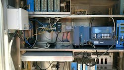
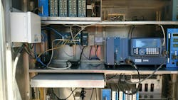
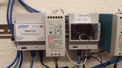
UDOT installed DSRC roadside radios on 30 intersections along this segment of Redwood Road. Unlike most DSRC corridors around the nation, a conscious decision was made to include multiple brands of hardware to facilitate interoperability testing of both hardware and software applications. In addition to DSRC radios, small stand-alone Linux computers were installed at the intersections to run the MMITSS software. The hardware cost for each signalized intersection was roughly $2,600, approximately equivalent to the cost of a signal controller, plus installation labor. Procurement and engineering oversight was handled by in-house UDOT engineering staff. Hardware installation and testing as well as software modifications were performed for UDOT primarily by The Narwhal Group and Synesis Partners.
DSRC radios installed at signalized intersections along Redwood Road were used to broadcast both the Signal Phase and Timing (SPaT) message and the intersection geometry (MAP) messages. The SPaT messages provide real-time information about signal operations, such as which legs of the intersection have red lights or green lights, and when those configurations will change. The MAP messages define how many lanes are in the intersection, whether each lane is a through lane or a turn lane, what the lane widths are, etc. MAP messages were created based on high-resolution aerial imagery and confirmed with field surveying.
DSRC on-board units were installed in several UTA buses, along with the small Linux computers. These systems were connected to power and communication systems on the buses so that the bus schedule and occupancy can be queried by the MMITSS system. The on-board radios broadcast information about the bus location and heading, known as the Basic Safety Message (BSM), and a Signal Request Message (SRM) when threshold criteria are met.
The MMITSS system on Redwood Road became fully operational in November 2017. Four buses are currently outfitted with DSRC devices, and additional buses are scheduled to have hardware involved in the next few months. While there are a number of DSRC-based test beds around the country, Redwood Road is the first fully operational V2I DSRC application in the U.S., where the transmitted data is being used in day-to-day operations of a transportation system.
DSRC on-board units were installed in several UTA buses so the bus schedule and occupancy can be queried by the MMITSS system.
The why of it all
The intent of implementing MMITSS on Redwood Road was to improve schedule reliability of the UTA bus along that corridor. It is important to evaluate the effectiveness of the system in achieving that goal, and also to evaluate the impacts on other traffic. In early 2017, a contract was entered into with Avenue Consultants to perform this evaluation. Their effort includes before-and-after studies along the corridor, using data generated by the MMITSS system, signal performance data obtained from UDOT’s ATSPM system, GPS data, and service data obtained from UTA on this bus route. That evaluation will be completed over the next few months.
Vehicle-to-infrastructure systems promise to transform transportation management and significantly reduce traffic crashes. UDOT’s deployment of this connected vehicle corridor on Redwood Road represents a first significant step to the implementation of many safety and mobility applications using this technology. Although MMITSS is a mobility application, and will not directly impact transportation safety, valuable lessons were learned from the deployment of this technology. Issues surrounding hardware specifications and procurement, wireless communications, software standards, equipment installation, and operational parameters were all encountered during the process. This learning process will set the stage for future deployments.
AASHTO, the Institute of Transportation Engineers (ITE), and the Intelligent Transportation Society of America (ITS America) have jointly supported a deployment effort known as the “SPaT Challenge.” In this effort, transportation agencies around the country are being challenged to deploy DSRC units on at least one signalized corridor of about 20 intersections in every state by 2020. These deployments should broadcast the SPaT and MAP messages. To date, over 30 agencies have committed to meeting the SPaT Challenge, and seven of those agencies have completed their deployments, including UDOT.
In addition to the SPaT Challenge locations, the U.S. DOT has funded three large connected vehicle deployments, in Tampa, Fla., New York City, and Wyoming. These sites, known as pilot deployments, will create a variety of software applications and install V2I equipment along the roadside and in thousands of vehicles, using DSRC and other communications mechanisms. Some of the applications they are developing include warnings to drivers about vehicles running red lights, notification about vehicles out of the driver’s view that are suddenly braking, warnings about unsafe curve speeds, warnings about appropriate speeds at school zones and work zones, assistance in safely making left turns in intersections, and pedestrian presence warnings. While on-board vehicle sensors may provide similar safety benefits in some cases, many of these V2I applications provide information about conditions that cannot be seen by the driver or the vehicle’s systems.
UDOT plans to expand this connected vehicle deployment both geographically and in scope. Another transit signal priority corridor is being planned for deployment in the summer of 2018, also using MMITSS, and design is underway to use this system to provide priority to snowplows when they are actively plowing. Discussions also are underway to identify additional applications that can be deployed along Redwood Road or other locations, including safety applications.


