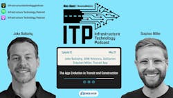
Infrastructure Technology Podcast: The App Evolution in Transit and Construction

Key Takeaways
- Jake Bailosky developed the OnStation app to solve a specific pain point in the field: determining exact location on a project site. Inspired by golf yardage apps, the tool automates stationing for road workers and inspectors.
- The app immediately improved field efficiency by eliminating manual calculations and replacing measuring wheels—offering instant location data to crews and helping streamline project documentation.
- Transit App’s new bike routing feature prioritizes safety by routing cyclists through protected lanes and quieter streets using OpenStreetMap data, with visual warnings for busy roads.
- Real-time data accuracy is critical not just for buses but for all modes of transit; Transit App’s ongoing feedback loops and data refinement ensure reliable and accessible trip planning for riders.
About the Episode
There’s an app for everything these days—even for navigating construction zones and biking city streets. In this episode of the Infrastructure Technology Podcast, host Gavin Jenkins and co-hosts Harlee Hewitt and Brandon Lewis dive into the transformative role of apps in transit and construction. Gavin speaks with Jake Bailosky, the former ODOT engineer who created OnStation—a job site location app that revolutionized field operations. Then, Brandon interviews Stephen Miller, policy lead at Transit app, about how real-time data and turn-by-turn bike routing are enhancing the rider experience. From simplifying site inspections to safer cycling routes, this episode explores how app-based innovations are streamlining infrastructure work on the ground and on the go.
Transcript
Gavin Jenkins (00:01):
Welcome to the Infrastructure Technology Podcast. I'm your host, Gavin Jenkins, senior managing editor of Rhodes and Bridges. And with me as always, we have the jack of all trades at Endeavor Business Media, Harlee Hewitt, associate Editor, Roads and Bridges. And then we have the man, the myth, the legend, Brandon Lewis, associate editor of Mass Transit Magazine. Today we are talking about apps. Applications. For those of you who don't know. And question off the top, if you could invent an app, what would it do?
Brandon Lewis (00:43):
Okay, I have my number one answer completely off the top of my head. I wrote about this in our November, December issue of 2024 about Transit Magazine.
Gavin Jenkins (00:55):
Really?
Brandon Lewis (00:55):
Yeah, ahead of the curve because it actually goes hand in hand with my feature story, which was on Paratransit, which I use regularly. If I were to invent any app in the world, it would be an app that would be an Uber or a Lyft type service app that would allow paratransit users to track exactly where their ride is, because right now it's not available.
Gavin Jenkins (01:24):
Yeah, that's really good. That's really good. Wow. You should probably, someone might steal that from this episode.
Harlee Hewitt (01:35):
I was going to say.
Gavin Jenkins (01:36):
That's really good.
Brandon Lewis (01:38):
There's my shark test. There you go, guys.
Gavin Jenkins (01:41):
I mean, whenever I think of apps, I just go to that episode of Curb Your Enthusiasm, where they do the Seinfeld reunion with the eye toilet, which was just like a map of all the public restrooms in the area. And that's where my mind goes is right to the toilet, and you're coming at us with something that would help society. That's amazing.
Harlee Hewitt (02:06):
I know.
Gavin Jenkins (02:07):
Harlee, what do you have?
Harlee Hewitt (02:09):
Mine would be something that is not going to help anyone other than me probably, but I have a mini Australian Shepherd herder mix, so if anyone here listening knows anything about those breeds, especially mixed together, they can be quite talkative and also just rambunctious in general. So I think if I could invent any app, it would be paired with, it would have to be paired probably with some kind of device that goes around their neck or something. But you could turn down the volume of their bark and it somehow goes into the collar. It's a bubble around their head or something. It tones down their barking because this dog has the most piercing bark of any dog I've ever heard in my life.
(03:08):
It's going to make me deaf before I'm 40. Most likely that would be mine.
Gavin Jenkins (03:15):
No. So you have the ability to creep any app you want, and instead of translating what the dog is saying to you, you want to just turn it down?
Harlee Hewitt (03:26):
Well, perhaps with a paid subscription we could do that too.
Brandon Lewis (03:31):
Well, if you guys have ever seen that movie Strays that came out last summer, I think it accurately reflects what dogs think of humans.
Gavin Jenkins (03:44):
Whoa. With Brandon, are you saying you're not a dog person?
Brandon Lewis (03:47):
No, I have a dog I adore dog. I'm just saying it accurately portrays what dogs think of humans
Gavin Jenkins (03:56):
I think, oh, I didn't see the movie, I thought, but I know that it was kind of R rated, so I thought maybe that they think poorly of humans.
Brandon Lewis (04:05):
It's R rated just because of the language, let's put it that way. We're PG here on the ITP.
Gavin Jenkins (04:09):
We're PG all the way. If I had to create an app, I wouldn't do the eye toilet. That's George Costanza's. I really have no idea. I've never really thought about it until today. I really would just want, I guess I would want an app that helped me, and I guess chatGPT can do this too, but I would just want an app that would help me respond to my girlfriend better, how to be caring and empathetic. She'll text me something and I have to think what is, I try to tell somebody's mood via what they're texting you or words. That's another that would be really good, but I want to respond to her and not get in trouble, or I don't want to respond to her. And based on that mood that you're talking about, like, oh, okay, interpret this. What would be the best way to respond? I don't know, but I think ChatGPT does that. So yeah.
Harlee Hewitt (05:36):
Amazing.
Gavin Jenkins (05:37):
Okay. Well, we are talking about apps today and with that, the first interview is mine and I'm talking to Jake Bailosky. Jake Bailosky. If you don't know him, he honestly, in my opinion, should be a legend. He was working for the Ohio Department of Transportation. He was an engineer, transportation engineer in the Cleveland area. And he came up with the idea for OnStation and he developed it. And now on station is this own thing. He no longer works for the company. He found another job that helps him really just scratch that engineering itch instead of being in charge of a company. So OnStation, for those of you who don't know, is an application that provides road workers and contractors with the quickest and easiest way to know their location on the job site. And it sounds simple, but every DOT uses this. And without further ado, here is my interview with Jake.
(06:52):
Jake, welcome to the Infrastructure Technology Podcast. We have talked before, and so I'm a little bit familiar with your story, but our audience is not. But let's start with, I guess it's what, 2012 your story begins 2013 where you're working for the Ohio Department of Transportation. So tell me about your role with the Ohio DOT and how you developed OnStation.
Jake Bailosky (07:29):
Sure. So I graduated from the University of Dayton with a civil engineering degree in 2009, and I was fortunate enough to get a job opportunity with the Ohio Department of Transportation. And there they had two career paths for civil engineers, one for planning and engineering and the other with construction. And I felt like that was my ticket. I wanted to be out in the field. I want to be interacting with construction and the people working on the job. So I chose the construction career path and I was a construction engineer for roughly the 10 years was my tenure at ODOT before I split to go full-time with the app and die ball in.
Gavin Jenkins (08:14):
And let's just jump ahead very quickly. You're no longer with OnStation, you left in 2022.
Jake Bailosky (08:22):
That's correct. It's been about two years now. I don't actively involved with the company operations or even at the strategy level. And we had a clean spit and I'm split and I moved on to a new chapter. I work with OHM advisors now as a construction manager leading a team of talented different ages and experience in construction project management. So basically inspecting engineering, project management infrastructure projects for local communities around the Cleveland area. OHM is much bigger than that in the Midwest region and beyond. But that's our task. And I got back into construction engineering and now as a manager
Gavin Jenkins (09:07):
And what we're not really interested in the business aspect, but we're focused on, and what our audience wants to know is how you develop the app and what it does and how that app helps engineers and crews on the ground on construction sites. I imagine that a lot of people who work for dots across the country use ont are thankful for ont. And I also think some of them probably have dreams of starting their own apps. So let's go back to 2013 and when did you first get the idea for the app?
Jake Bailosky (09:51):
Yeah, so I started out working primarily in the field as an inspector and then as an engineer worked my way up. But yeah, I was just sitting out in the field working on construction projects for a while there, thinking about how can we improve the way projects are delivered? And really almost selfishly, how could I do my job easier leveraging technology, especially mobile technology, which was really on the come up at that point in time back in 20 10, 20 12, about that time. And I was looking for productivity tools to find my location to take notes utilizing the map. And there just really wasn't much available in the app store. A lot of the apps were very simple, not fully functioning. And to me it was an opportunity to try building some tools with mobile technology, specifically app technology and start finding a way to locate using the app. And that's something I did every day on the job. And it's just completely essential for knowing your location when you're on the project to take notes and describe what's going on and interpret the plans.
Gavin Jenkins (11:02):
Okay. Tell us some more about the initial features you developed on the app and why.
Jake Bailosky (11:11):
Yeah, so first and foremost, the app is called OnStation and it provides automatic stationing. It's your location, your position on the road, which everything is described in the plans. And really, I had a sports background and I enjoyed golfing. And back then they had apps developed to tell you your yardage from the hole, which helps you pick out the club and hit it on the green there. And it just clicked in my mind that it can tell you it's referencing a point from the tee to the hole and giving you a distance. And similarly, that technology could probably be used to tell you your station if it had the right reference points and the right design and development behind it. And I really just borrowed that idea and that technology and made a new, very practical, useful use case for it on the project to interpret stationing as opposed to your distance for playing the game of golf
Gavin Jenkins (12:11):
You deployed on station for the first time on a project. Was it for the Utah or Wisconsin Department of Transportation and then what were the results? Or was it both DOTs?
Jake Bailosky (12:24):
Well, the first time I ever did it was just a prototype on my own project for my own personal use. And there I was able to validate that it worked because I built the center line alignment with stationing on a big highway project and I can go out in the field and have it interpreted automatically and it clicked it, it was awesome, it solved the problem and I put a lot of effort into trying to figure out that problem and it worked. And then from there it was like, okay, I'd like more people to, everyone could benefit. Anyone who's working on the project has the reference stationing could benefit from this handy tool in the app. And I worked with the Ohio Department of Transportation, so I wanted to avoid any conflict of interest. It's not a tool that they could readily adopt and implement at their level. So I focused outside of Ohio and sought out contractors working on large DOT projects and I worked with the contractor RL Wadsworth and the Wadsworth brothers in Utah working on a big Department of transportation project out there. And they liked the idea of it. They said, Hey, put our project in the app and we'll go ahead and give it a try. And it was very successful on that project with the contractor. And then it grew with the other teams, including the DOT on that project.
Gavin Jenkins (13:45):
Whenever you were getting those initial results, I guess the fuel to what you were doing was the efficiency. So would you say that it made job sites more efficient right off the bat?
Jake Bailosky (13:59):
Yeah, and the efficiency was most realized by the user, the worker doing their job out in the field, taking their notes, making inspections and building the project. So what you would normally do, I guess the traditional way at the time was using a measuring wheel, finding a reference in the plans and measuring a distance off a survey stake or a landmark and it was very physical. You had to walk that off, you had to do a quick calculation and that's what the app did all on its own using the location technology, the survey built into the application and the map, it would instantly calculate that station. So it answered the question, where are you at and what are you doing? Which starts a lot of conversations of what's going on in the project and how do we deal with these issues and work forward. So yeah, you pull up the app, you pull up your project there, it has your blue.as a location on the map, and it's giving you that station right away. So you get right to the point there having the information on hand and you start your conversation and you do your work from there.
Gavin Jenkins (15:04):
Yeah, and I remember the reason I came onto this app and learned about it was I was doing a story for our magazine on a project in Kansas and I was speaking to an engineer at the Kansas DOT, and this engineer, I forget his name, but he said that he couldn't work without on station. And so I imagine when you started to get those results and hear the feedback from contractors and other DOT employees, that must've been so validating. What was that like?
Jake Bailosky (15:44):
It created just a lot of excitement and I felt it going into it that that's a good problem to solve, but then when you're using it, something that takes time, you check your station multiple times a day, every day on the project, and just to save that time and to have that information at your fingertips just makes a lot of difference and the way people work. So for them, I really wanted to get that technology out there as much as possible on every project to know was the idea and to all these workers hand to help them do their job, a job that I was very familiar with. And that's what really got to going down the business route. In addition to creating a cool tool in the app,
Gavin Jenkins (16:28):
What do you think some of your key takeaways are? I mean, speaking, there's probably just thousands of young engineers out there who want to use technology to streamline the process in a better way, make things more efficient. What were some of the key takeaways that you learned? Was it just lightning in a bottle that it just clicked or were you searching for something like this?
Jake Bailosky (16:58):
Yeah, are you talking in terms of they want to create the technology or just use technology that might be available?
Gavin Jenkins (17:05):
Let's start with just creating and then go to using what's available.
Jake Bailosky (17:09):
Yeah, sure. Naturally you have something in mind, a potential time saver or value add to your experience or your team or the business, and you start looking around naturally search the web. You can search the app stores and see if there's a software, an app out there that exists. And if not, you might be onto something and it's worth pursuing. I think if you're working on the job, you have an understanding for the most part of if it would be helpful or not. That's one thing. And then the other thing down the line is will other people take onto it and will people invest into it? But yeah, if there's nothing around out there of what you're thinking or the problem that it might solve, then you might have a unique idea and an opportunity to develop something new, something that adds value, and then there's various ways you can pursue that, whether you're developing it, working with the team to put up some of a startup idea or business together and move it forward.
Harlee Hewitt (18:11):
Alright, now let's talk about other things that are used. So this is like an app from 10 years ago, so so much has changed since OnStation was invented and I'm just curious as to know what kind of technologies or other apps that you've seen out there that have impressed you and you've seen used in day-to-day work?
Jake Bailosky (18:38):
Sure. So OnStation fits into the category of a field data collector and other apps out there like it. I'd say Field Maps is a very popular one and you can drop a pen and you can enter information about that pictures, texts, details, if it's work specific. So what I'm seeing out there now is on station in the mobile app, the device itself, your phone or your tablet can get you within roughly about five feet. In a lot of cases it can get you closer in that, but reliably within a few feet and that's great for 95. Most of the things I'm telling you where location is, but the level of expectation is increasing with location technology. So now they're pairing the mobile app with a GNSS receiver, which is a separate unit, it's a survey instrument and that's going to make a precise, give you a precise location of a couple centimeters or down to a centimeter that can then go into the app and just give you a more precise location description that can then be utilized to track the exact location of something as well as taking more accurate measurements. Because taking measurements and tracking pay quantities is just an essential part of the job too.
Gavin Jenkins (20:01):
Okay, that's really interesting stuff. And obviously artificial intelligence AI has burst onto the scene just in the past couple years. It was probably unthinkable when you started your career and when you launched ont. I'm just curious, in your day to day, how do you interact with AI?
Jake Bailosky (20:21):
I think AI is, you're right, it wasn't on the scene when I started OnStation and it certainly is now and it's evolving quickly for now. You can utilize online searches like a Google search, all the major technology providers have a AI agent to them and you can ask them general questions and help you get to answers faster. Now that comes with a big sign of caution that they're not going to give you exact answers, but they can start putting you right in the right direction, especially if you want to build a knowledge around a certain aspect of work or it can even point you to particular specifications. I think it's still somewhat immature in the sense of it hasn't fully produced practical solutions in the construction space, but I know that there's startups out there working on it to prove me wrong and show what it can do and bring some solutions to the field.
(21:15):
But I was even thinking about it more recently, the AI can interpret a lot of data run analysis and provide feedback on that at a rate that you couldn't do on anyone on their own. So it could save a lot of time and research and their running through data. And one idea that I've kind of thought about is we get a lot of data on their projects in terms of time tracking and how we're spending time on projects and how those budgets are matching up from what we anticipated estimated going into the project versus the outcome, whether it's within budget over under, and we're doing that at a mass scale, especially larger companies and the numbers of projects they're delivering. And you could really use a tool like ai, a technology like type AI to run analysis and compare where all that data rolls up into and why you're performing positively or negatively or on those projects to help you understand some of these estimations and on the backside give you a report and then accumulate all this information to make predictions and provide feedback on the performance of that as well as insight into trying to really hone that out and dial into things that you might be missing just by your own analysis
Gavin Jenkins (22:37):
That I couldn't agree more. And I think that that sort of technology, the apps that do that are going to use AI and we're going to see more and more of those in the industry for sure. And hopefully it comes from people like you who know the industry and create it after having been on the job site. I think with technology, so many times things get created by people who are just in Silicon Valley and don't really have much of a connection to the industries that they're disrupting and that's what they end up doing is sometimes disrupting instead of making things more efficient. And that certainly was the case with ont. Have you gotten feedback lately or from anyone else in the field about how much they love OnStation?
Jake Bailosky (23:33):
Not so much recently, and that's not really, I don't come across that on the day to day so much other than people recognize it and even part of making this interview happen, word gets the background in different ways, but I did hear a lot of feedback while I was developing the app and I was very engaged with the customers and throughout hearing all those success stories for individuals as well as the teams out there, and it just felt great. It make you feel like you put all this time and effort into developing this idea. Part of it is just wanting to get it out of your system and see it through and following through on that commitment. It can be done and you don't think many other people are doing it and then you could do it. But when it finally gets out there and they get to use it and the benefit, the full idea was to help people do their job easier, save them time, improve their work experience. And I feel very confident with OnStation that it does that when they're getting their hands and they provide that feedback and provide not just positive reviews in the app store, which are great and we appreciate that, but that's one of the best things I can say about ont is we get tons of positive feedback and they continue to renew when that annual license runs up and they re-up and they continue to bit.
Gavin Jenkins (24:59):
Alright, well Jake, thank you so much for joining me and for talking to us here on the Infrastructure Technology podcast at Endeavor Business Media. Alright, I'm Gavin Jenkins, senior managing editor of Roads and Bridges. Thank you for listening.
Brandon Lewis (25:19):
And welcome back to the Infrastructure Technology podcast. That was Gavin's interview with Jake. Gavin, I got to say, man, what I found so fascinating about that entire interview was he developed the whole app based on the yardage of the hole in golf.
Gavin Jenkins (25:43):
And he is just a highly intelligent guy and also hardworking. I mean he was doing that in the edges of the day and I think that everyone who listens to this podcast knows when you're an engineer or a contractor and you're out there in the field doing work all day to then go home and develop an app, it's insane. That's drive, that's talent, it's innovation and its intelligence. And that's Jake Bofski and the Cleveland area is really lucky to have him really. So and yeah. Harlee, what did you think?
Harlee Hewitt (26:29):
I think it's amazing. I think the thing that I like the most about this is that it's, of course you want technologies that are going to benefit the contractor overall and drive revenue. That's their whole in business. But this is something that's really helping people who are actually working on the ground to do their job a bit easier and also be quicker to keep up with the pace of heightened infrastructure projects. So this stuff used to only be able to be done with expensive survey equipment, so now it's truly in your phone. And I think that's, like he said, that really is innovation. So I was really impressed with that.
Gavin Jenkins (27:15):
So Brandon, up next we have an interview with Stephen Miller, not the person who is an advisor to President Trump, but the other Stephen Miller, the Mass Transit Stephen Miller. Tell us about this interview.
Brandon Lewis (27:33):
Yeah, the Stephen Miller who is the policy leader at Transit app and he's been there at the transit app since 2017. He became the policy leader in 2023 for Transit app, but before that he was the ex communications lead for five years as well as the app's transit data analyst. What we talked about today is transit agencies use this transit app as sort of a navigation tool. It's a way for riders to track where on a regular fixed bus route, a certain bus may be where it's going, etcetera. But Transit App developed this sort of turn by turn technology for bike users and helping improving bike usage on sidewalks and roads and making it easier for people with bikes to navigate where they need to go while riding their bike. So it's a very fascinating interview and there's a lot of the technical side of the technology that you may not think about when developing an app specifically for bike users. That's what we get into. And without further ado, here is my interview with Stephen Miller, the policy leader at Transit.
(29:00):
And welcome back to the Infrastructure Technology podcast. I am Brenda Lewis, associate editor of Mass Transit Magazine. With me today is Stephen Miller, the policy lead at Transit app. Stephen, welcome to the ITP.
Stephen Miller (29:17):
Thank you so much for having me.
Brandon Lewis (29:18):
Thank you. So we are here today to talk about a bunch of different innovations the transit app has recently launched and one of those is a feature for Safe bike route. So this app has just launched at the time of this recording in October, 2024. So how was this feature in development?
Stephen Miller (29:44):
So features that we add to the transit app, depending on the size and the complexity of the feature can take anywhere from a couple months to a couple years to really develop both the design, the backend and then the front facing user interface and then launch it to users. So for this particular feature, it took a year plus to really put everything together. It included a number of different pieces. So first was obviously people open up the transit app for public transit to know where your bus is, find a trip from A to B, but our trip planner also does include bike information and it has since 2017. But those bike directions weren't really focused specifically on safety and weren't really customizable to kind of get under the hood a little bit. We used what was called open trip planner for their bike directions at Transit.
(30:56):
We have our own trip planner for public transit. We think it gives you the best trip plans from A to B. And so what we set out to do was to create our own trip planner engine to come up with trip plans from A to B by bike that really prioritized safety. And so that was step one was developing and then launching pretty quietly those improved bike directions. And then step two was adding on turn by turn navigation using our Go feature, which already exists for public transit. It tells you when to leave for the stop, when your stop is coming up. We added go for bikes. So when you tap go on a bike trip plan, it'll tell you where to turn, which streets are safer, which ones have more car traffic, and then help you navigate that trip from start to finish. So you can either put it on your handlebars or you can keep it in your pocket and it will help you navigate. So altogether it took more than a year to really improve the quality of the bike trip plans and then come up with that step-by-step, turn by turn interface using our Go feature.
Brandon Lewis (32:19):
What's the difference in technology? Obviously it's different when you're talking about transit a bus versus riding a bike and as you said, making those manual turn and turn navigations. What's the difference in the app features less technology and making that they are accurate because as you said, everybody whether it's a car or some other foreign transportation is moving in real time. So to ensure that the app and the information that it's giving out is as accurate as possible.
Stephen Miller (32:56):
Yeah, you really got I think an important point there, which is the most important thing is the fundamental base data that's being used to provide trip plans to people. So, on the public transit side we rely on data from transit agencies in GTFS format and then GTFS realtime, which adds realtime information on top of that scheduled GTFS information. GTFS is a standard across the industries, across the public transit industries. If you work at a transit agency and you don't know what GTFS is, there is someone at your agency who does. And it is really critical to communicating to riders using apps, what the type of services when the next bus is coming and making sure that that information is up to date and accurate is super critical. So, on our side, we have a whole team that works on this data as it comes in from transit agencies and provides feedback to transit agencies about their GTFS to make sure that we and others are getting the right information to riders about public transit.
(34:17):
On the bike side, it really comes down again to the quality of that information about where bike lanes are, what streets are busy arterial streets and which ones aren't. And the source of that data for us and for others as well is called Open Streete map. It's essentially Wikipedia for maps, right? It is a worldwide open source map where people can contribute their, if let's say a bike lane opens on your street, you can go into Open Street map and edit the map and update it to say there's now a bike lane here and then we will take that into account and route people accordingly. So it's really that base level of information through OpenStreetMap that helps our trip planner engine come up with the best rest.
Brandon Lewis (35:12):
So if I'm hearing you correct, that means essentially anybody in the area using that app can go in and update it and that transfers back to you guys?
Stephen Miller (35:24):
Exactly. And not just to us, but to apps and companies and services all over the world. Right? OpenStreetMap is really great because this kind of base of open data allows folks like us to build additional features on top of it and make them available to folks. So yeah, OpenStreetMap is somewhat technical, right? You've got to be a bit of a committed nerd to go into Open Street map and make the edits the right way and be a part of that community. But for those who are the changes they make do have a big impact.
Brandon Lewis (36:06):
So how quick does this data transfer? Because let's say the data, oh, this bikes Wayne on this street is pretty clean and the person is coming to that street that you're going to make the turn all of a sudden it becomes crowded as we talked about, it happens in real time. Is there ever a scenario where somebody is about to make a turn or something and the street all of a sudden becomes too overpopulated?
Stephen Miller (36:40):
So our bike directions aren't done in real time. They rely on open street map information about where there are bike lanes, which streets are arterial streets. There is not an open source real-time information for traffic the way that there is for transit, right? So when you use, let's say Google Maps and you get the red, yellow green to know if there's traffic, that's proprietary information that Google is using. When you open the transit app and you get information about a bus coming down and you can see if the bus is crowded or if there's plenty of seats available, that information is provided by the public transit agency openly. So when someone to kind of go back to bike directions when somebody is getting bike directions in the transit app, what we're showing them is what our trip planner has determined to be the safest route based on where bike lanes and different types of streets are located around their city. So we try to really route them onto quieter residential streets onto protected bike infrastructure and away from major arterial streets.
Brandon Lewis (38:12):
Now the trend have designed this bike running algorithm around four safety principles. Can you talk a little bit about the safety principles?
Stephen Miller (38:21):
Yeah, sure. So, the best way to think about bike routing is really the fundamental question is, is it safe, right for people? That's the barrier to getting on a bike, right? Because too often you'll hear somebody say, I would love to bike, it's only a 15-minute bike ride, but I just don't feel safe myself or with my kids going down this busy road, there are cars nearby. So our bike directions really try to prioritize separating people from cars and particularly from heavy traffic, high speed streets. So the four principles are really, the first is focused on routing primarily to protected bike lanes and paths because those are really the safest option for folks. The second is recognizing that paint on the street isn't necessarily protection from cars. If you're on a street, if it just has a little bike icon in the middle of the road, that's nice, but it doesn't necessarily protect you from cars that are going by.
(39:39):
So our trip planner has a small preference for bike routes that aren't protected, but it's really negligible. And so when we can't find the protected bike path and separated bike lanes, our third principle is that we prioritize quiet streets. We really want folks to go towards those residential streets where there are fewer cars going at lower speeds. It's a much more pleasant environment to be riding in. And then the last principle is if we determine that there's no way around a busy street, if there's no alternative and it's really the best option, we will visually notify the rider in the app to know, oh, this street is a heavy traffic street. You should be aware. So we mark those streets in black with an orange warning icon because the worst thing is when you go off on a bike ride and then suddenly unexpectedly end up in an inspiration that feels a little dicey.
Brandon Lewis (40:52):
And so that shows up on the map itself then?
Stephen Miller (40:56):
Exactly. And it shows up on the map and we show a little chart that marks out your trip and on that chart we show the elevation, it goes up and down, and we highlight which sections have protected separated bike lanes, which ones are on residential streets and then in black, which ones are on those busier streets.
Brandon Lewis (41:19):
Well, we'd go out today about the development of the app, the testing of the app, and the testing with users. What was that process like?
Stephen Miller (41:31):
So as much as we can come up with a great algorithm and test, it really requires hearing back from rider and hearing back from people who actually use the app. If there's something that has gone wrong that we sent them on a bad route, we want to hear about it. So if anybody is listening and they use the app, I really encourage them to go into the settings menu and hit the contact us button. Anytime they encounter something that's not right, take a screenshot, send it to us. Our team looks at every email and it really does help us improve the app anytime something goes wrong. And so right before we launched, we shared information about the new feature with folks who we knew in the industry who worked on bike planning, who were bike advocates, who really kind of had an expertise in the subject and asked them, if you're willing, we would love for you to plan a couple of trips that you use every day that you're familiar with and let us know how we did.
(42:43):
And that was really helpful. We heard back from folks from coast to coast who used the app who were experts in the bike facilities in their local areas to help us improve. Sometimes that meant that we had to improve the underlying data from open Streete map. Maybe there was a bike lane that was missing or incorrectly added in the data. Sometimes it meant that we had to tweak the way our algorithm proposes trips. So one example of something we heard back from folks was, I love the trip, it's really safe and secure, but it's sending, it's making me do too many turns. It's too confusing, which is legitimate. You're not always going to remember or know to make the turn. And so we've been adjusting our algorithm and reducing the number of turns that folks have to make while still keeping them on those safe streets. And then after we launched, we heard back from users across the US and Canada and everywhere that the app works to say, oh great, thank you so much for the new feature. And by the way, here is something that maybe could be tweaked. And that really, really again does help us when we hear back from users.
Brandon Lewis (44:05):
Now you said at the start of this podcast took about a year of planning and developing to really get everything off the ground. How long was the process of testing with users? Was it about the same time?
Stephen Miller (44:20):
It is kind of a trick question in a way because the process of testing with users never ends. Once something goes out to users, it's not like we say, oh congratulations, job done. We don't have to think about this ever again. We are constantly hearing from users making adjustments, and that applies on the bike side, but also on the public transit side as well. We are the transit app and we hear regularly from users and we constantly adjust and approve the way that we display information in the app or the quality of the base data in the app just to make sure that folks are getting that best experience that they can. So I mean, to answer your question, it's really a never ending
Brandon Lewis (45:08):
Perfect transition though, because now we're going to talk about the public transit side. We spent a lot of time talking about the bike side of it, but as you mentioned, you are the transit app. So let's talk about the quality of schedule and real time data that the actual transit app provides for public transit.
Stephen Miller (45:29):
Yes. So I mentioned earlier the information that comes into the app is provided by transit agencies themselves in GTFS format, which is that standardized format for schedule and real-time information. And so one of the things that we do is we work really closely with transit agencies anytime that we or our users identify an issue in the data to let the transit agency know and then work to come up with a solution for that. And that applies both on the schedule side of the equation to say, for example, oh, this stop isn't located in the right location or this schedule is slightly off to the real time side of the equation. There is a benchmark that we developed with swiftly and with others in the industry called the ETA accuracy benchmark. And we helped to develop it in part because there was no universal way to measure whether a real-time countdown was accurate. If you're standing at the bus stop and it says your bus is going to come in five minutes, four minutes, oh no, six minutes, one minute. That's a frustrating
Brandon Lewis (46:50):
Experience. And we know when it comes to public transit down to the minute, the difference between four and five minutes, it may not seem like a walk, but it matters, especially people on both sides. It matters to the consumer who is trying to get to work or trying to get to appointment or wherever they're trying to get to, but it also matters on the side of that boat is not going to stick around and wait. And so if you're one minute away, that could be the difference between you making it and missing it.
Stephen Miller (47:23):
It can be the difference between you making it and missing it. And it can also be the difference between you wanting to take public transit and you wanting to get a car, right? If you get that experience even once, it can be a real turnoff to say, I can't rely on the transit system every time I ride it, I miss the bus or it never comes. And so making sure that that information is accurate and that it's constantly improving is really critically important. It's something that there are folks in transit agencies who really have, they're in the weeds on the data, but if I have a message to folks at transit agencies, particularly at the general manager level, the CEO level is really pay attention to the quality of data that you're putting out because that has a huge impact on the experience that your riders are having and whether they want to keep riding with you.
Brandon Lewis (48:23):
Well, and you mentioned ridership and accessibility and testing and all that, and I think one of the things that we're seeing, and yes it is coming with the younger generation, but I think all also increasingly as everybody gets older, the use of technology and the access and the things that we have, as we've talked about with all these apps and the real time info, everybody expects everything to be so accurate. And when things are not working or things are off, it's a turn off because I think we're just so used now to fast paced everything available at our fingertips. So, if everything is not sort of perfect for us or everything's not working, that can be sort of a turnoff.
Stephen Miller (49:09):
Absolutely. It's not something that affects a small segment of the population. Smartphone adoption is very, very high, even among seniors, even among low income people. For many low income people, a smartphone is their only connection to the internet. And so making sure that the mobile experience is as good as it can be for public transit. If we were talking about this 15 years ago, you could say, well, that's for a tech savvy young population, but nowadays it's the expectation of everybody.
Brandon Lewis (49:48):
So, we talked a lot about the bike side today. We've talked a lot, obviously about the transit side today. Is there any more tweaking or room to expand the app to do even more functions on either side or maybe even what's coming next? What's the next innovation for the transit app?
Stephen Miller (50:09):
Well, we talked a lot today about getting information out to riders, whether that's the bike directions or the quality of the transit information. I think the next step, the next generation is something we've started to work on and something we'll do a lot more of moving forward, which is getting information from riders back to transit agencies and decision makers, right? It's about having that kind of two-way loop so that at transit agencies, you can hear from your ridership in a kind of ongoing, regular, standardized way. Because often when you hear from writers, it's usually because somebody had a very bad experience or sometimes a very good experience and they felt motivated to take the time to write in or to call in when in fact, most people just have a fine experience. Nothing remarkable, but it's good. And it's important to know that baseline and to identify where there are problems popping up that maybe don't rise to the level of someone wanting to sit on hold and call someone. And so we've been working a lot on our Rate My Ride feature, but also on various surveys and different ways to raise the voices of transit riders in a more systemic way to help transit agencies deliver better service. So I think that to me is the direction that a lot of the industry and particularly us at Transit are moving in, is to really put those voices of riders front and center.
Brandon Lewis (51:51):
Do you think there could be a way for that voice to maybe transfer over to the bike side? Because we are seeing a lot of emphasis from agencies now on e-bikes and scooters and different kinds of bikes as it's not just about bus, it's not just about rail. There are other different forms of public transportation.
Stephen Miller (52:16):
Yes, that's totally true. We've had it on our radar as something we'd like to do down the road of helping folks signal and share information about when their ride isn't going right, whether it's on public transit or whether it's buy bike. And the goal for us is really to help people live a full life without having to own a car. Our mission is very explicitly to make life better without a car, and that the core of that is public transit, but helping people both route their trips and feel like their voices are being heard on public transit, on biking, on walking on all of these modes is a core part of our mission.
Brandon Lewis (53:08):
Stephen Miller, the policy lead at Transit app. Stephen, thank you so much for joining me today and the Infrastructure Technology Podcast.
Gavin Jenkins (53:17):
Welcome back from Brandon's interview with Stephen Miller, and now we're going to wrap up the show. It's been a fun one, but let's talk about that interview first. Harlee, what did you think?
Harlee Hewitt (53:30):
They rely on a lot of data to specifically real time data to make sure that they're having the most accurate routes available for people and so that they know what's coming up, what delays they'll have, and just overall making it more efficient. So I thought that was really interesting, but yeah, really great interview. What did you specifically take away on the Mass Transit side, Brandon?
Brandon Lewis (53:59):
Yeah, so I thought Stephen did a really good job explaining that this out, that they developed. They always have this idea about, well, transit is about buses and rail and all that, but bikes are involved, but bikes are so tricky because you're not just dealing with roads and streets. It is the intricacies of dealing with signals, sidewalks, people, and traffic and just, it changes nearly every second. And so there could be a time where you're running down the sidewalk or even on the street and a road looks clear and you turn a little bit or you keep going a little bit and all of a sudden it's backed up or there's people on the sidewalk or there's something in the way or whatever the case may be. So to your point, Harlee, the importance of that real time data and not just real time data, the importance of being accurate with that real time data and then being fast enough to transition that as fast as the bicycle can go.
Gavin Jenkins (55:19):
Absolutely. And one of the takeaways I'd like to just mention is both of our industries need people like Stephen Miller and Jake. This is where our industries are headed and what we need is people developing more apps so that we can have more accessibility so that we can use the data that is changing the industry in ways that help everyday people just travel and commute and go from A to B easier. And so the traffic is smoother and the industries need young leaders to step up. Well, this has been a fun one, talking about technology and apps and how they're changing the industry. For Roads and Bridges, I'm Gavin Jenkins. We'd like to thank Brandon Lewis, and we'd also like to thank Harlee Hewitt, our co-producers and co-hosts. We'd also like to thank Endeavor Business Media, our parent company. Thank you for listening. We're just getting started. Tune in next week we'll have another episode of the ITP Infrastructure Technology Podcast. Until then, we'll see you next time.