Everything in between
Weather is a major factor in surface transportation—it impacts traffic flow and patterns, and is often a precursor to accidents, a significant portion of which result in injury or death.
During the period from late fall through early spring, all potential driving hazards are in play, from rain and snow to ice and fog. Wet pavement and rain have routinely proven to be the top two contributors to weather-related automobile crashes based on the 10-year averages, followed by winter-weather hazards and fog.
Every year, around 20% of all crashes, injuries and fatalities on the roadway are weather-related, and over 30 billion vehicle hours are lost due to weather-related congestion at a cost of nearly $3 billion to trucking companies.
Sensors mounted
Variable weather creates a tough battleground for highway transportation officials. Faced with extreme temperature and precipitation changes across a wide range of terrain—from mountains to grasslands—many state, provincial and local agencies are turning to new and unique ways to meet the challenges.
Using customized weather observations and forecasts driven by fixed Road Weather Information Systems (RWIS), transportation officials have been making better decisions that help to minimize the impact of snow and ice on road networks. RWIS data is collected, displayed and used within forecast models to understand future road weather conditions, and determine the safest, most efficient and environmentally sensitive method of treating the roads to ensure traveler safety.
However, there is a limit to how many RWIS can be installed and maintained. It is not feasible for many agencies to build and maintain a dense enough RWIS network to represent the variability on the roadway.
Covering more ground
Many agencies utilize large RWIS networks across their area of responsibility to help make decisions to remove snow and ice from the roadway. Yet there are still gaps, as even the densest RWIS network installs sensors every 5 to 15 miles of roadway, which can stretch across steeply varying elevations or highly variable microclimates.
To fill these voids, agencies are turning toward the use of mobile weather sensors—devices mounted on vehicles that gather and process information as it covers ground. Taking readings up to 100 times per second, the sensors directly measure pavement conditions, temperature, chemical concentrations, friction and other values with each data point’s GPS location. The data is transmitted via cell signal to a database and then integrated into the department’s weather decision-support graphical interface.
Weather-sensing technology has recently emerged to provide road-weather observations directly from moving vehicles. Mobile weather-sensing technology offers many new advantages for improved situational awareness and decision support for road maintenance operations.
Starting in Alberta
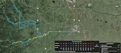
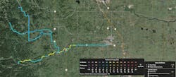
Canada’s Alberta Transportation (AT) has installed an extensive network of over 100 RWIS throughout the province of Alberta. AT’s Maintenance Decision Support System (MDSS) utilizes observations from RWIS to provide treatment recommendations for individual plow routes. Locations further away from RWIS observations rely on assumed road conditions to provide treatment recommendations.
Weather-sensor technology has recently emerged to provide road-weather observations directly from moving vehicles. Traditionally, these road-weather observations have been collected by the static RWIS, but mobile weather-sensor technology offers many new advantages for improved situational awareness and decision support for road maintenance operations. Mobile RWIS technology presented AT with the opportunity to provide more geographically specific observations for locations between RWIS, without incurring the cost of installing a full RWIS unit.
A pilot was proposed to investigate the value of mobile RWIS technology during the 2015-2016 winter season.
In a summary of the study of mobile weather sensors mounted on vehicles during that time, participants were particularly interested in:
1. How do mobile weather observations compare to existing RWIS observations?
Given where and how fixed and mobile weather sensors take measurements, some differences between the two were expected. For example, because embedded surface temperatures at a fixed RWIS station change slower than mobile temperatures, there can be a +/- 1°C difference measured in optimal and stable conditions. Variations in incoming or outgoing radiation can result in temperature differences of +/- 3°C. Gradients of +/- 2°C per minute can stem from the difference in mobile vs. fixed data sampling frequency.
As anticipated, small differences were observed during the trial. Measurements between fixed and mobile weather sensors compared quite well and fell within expected tolerances.
2. Can mobile weather observations be used as a source of additional information between RWIS?
Implementing mobile sensors enabled the road department to gather expanded information beyond the capabilities of fixed weather stations. For example, the mobile sensors provided an ice percentage reading, i.e., the percentage of ice particles on the pavement, as well as a measurement of friction on the road. In the future, mobile sensors could provide other readings as well. There are some capabilities being developed using mobile sensors such as fine-dust calculation and the capture of camera images as the sensor moves.
3. Do mobile weather observations have value to a winter maintenance operation?
The study noted cost savings and operational efficiencies directly attributable to the use of mobile sensors, and provided the following “before/after” anecdote as an example.
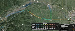
Traditionally, operators would patrol their routes every morning to check out road conditions. Cellular service is spotty in these areas, so they would finish their 30-minute route before calling in their observations. To respond to the threat of ice on a particular stretch of highway, operators would typically order two plow trucks and 24 tons of material.
With weather sensors now installed on its vehicles, the agency is able to react more quickly, with more precise tactics. Instead of responding to visual observations eventually called in from the field, supervisors can now receive real-time data. On this particular day for this same stretch of road, armed with the information from the mobile weather sensor, only one plow truck was dispatched with 12 tons of material, freeing up the other plow to attend to a different road.
With weather stations installed on vehicles, the agency is able to react more quickly. Instead of responding to visual observations eventually called in from the field, supervisors can now receive real-time data out on the road.
The observation ecosystem
Fixed RWIS and mobile sensors each play a unique role in an observation “ecosystem.” There are measurements a fixed RWIS provides that mobile sensors cannot, including wind speed, wind direction and sub-surface temperature.
Mobile sensors help round out vital information for decision-makers by transmitting hard data from the field and filling information gaps between fixed RWIS stations. Mobile observations provide quantitative measurements of the small-scale weather variability of the pavement back to decision-makers. This enables a more targeted treatment plan and results in resource savings.
State, provincial and local agencies are meeting these challenges head-on in new and unique ways by utilizing customized weather observations and forecasts to minimize the impact of snow and ice on the road network. Intelligence is collected, displayed and used within road weather forecast models to understand future road weather conditions so that the most economical and environmentally sensitive decisions are made to ensure traveler safety and mobility throughout the entire road network.
More out there
As technologies continue to develop, mobile observations will be utilized as input into pavement models to produce a more spatially granular pavement forecast for the geographies where readings are taken. During the winters when observations are taken, the pavement forecast will routinely be modified based on the findings from the readings, allowing small-scale changes in treatment and response to be made to keep the roads free of snow and ice. Crews that can more quickly and efficiently remove snow and ice from roads will aid in the dramatic reduction of vehicular accidents, thus increasing the safety of the transportation network and reducing the costliness of weather congestion.
As cameras become more common in vehicles containing mobile sensors, significant value also will be added to the overall data collected simply by providing a real-time view of roadways in addition to the weather conditions. Since patrol vehicles are routinely deployed before, during and after a storm, the addition of a camera would allow them to visually assess the effectiveness of applied treatments after a storm, and a mobile weather sensor could provide quantitative metrics to use in measurements of performance.