Bridges in Trouble
In March 2020, while the state of Washington grappled with the arrival of Covid-19, another crisis was beginning to unfold. Engineers discovered accelerated cracking along the West Seattle Bridge (WSB), with fissures expanding by 2 ft in two weeks.
City officials considered several potential factors driving the decay, including the 2001 Nisqually earthquake and heavier vehicles stressing a structure built for lighter loads. Ultimately, the Seattle Department of Transportation (SDOT) said steel inside concrete was stretched past its limit, due to what may have been shortsighted design thinking. It seems the bridge simply wasn’t built to meet evolving standards.
While some community members believe the city should have taken stricter measures when less severe cracks were first discovered in 2013, others say that annual inspections of the bridge helped prevent more devastating consequences. At the time WSB was shut down for repairs, the bridge was not in danger of imminent collapse (though it was certainly on the path to failure). Crews have since installed 10 miles of steel wires to add tension to both sides of the bridge, along with sensors that send engineers real-time updates as SDOT finishes structural updates. WSB, now scheduled to reopen in mid-2022, is one in a long line of bridges that require serious state and local attention.
According to the American Road and Transportation Builders Association (ARTBA), there are 167.5 million daily crossings on 43,578 structurally deficient United States bridges in “poor” condition. That squares out to one in three bridges that need repair or replacement, including 30% of bridges on interstates. ARTBA’s 2022 Bridge Report reveals states with the largest number of bridges in poor condition, including Iowa, Pennsylvania, Illinois, Oklahoma and Missouri.
The National Bridge Inspection Standards (NBIS) established condition ratings to describe an existing bridge or culvert compared with its condition if it were new. The ratings are based on the materials, physical condition of the deck (riding surface), the superstructure (supports immediately beneath the driving surface) and the substructures (foundation and supporting posts and piers). A structurally deficient bridge is one for which the deck, the superstructure or the substructure are rated in condition 4 or less.
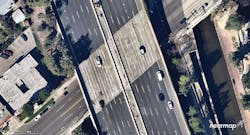
The four most structurally deficient freeway and highway bridges in California are in Los Angeles County, including the 101-Freeway overpass that crosses Kester Avenue in Sherman Oaks. It’s been up since 1959 and handles more than 300,000 vehicles per day.
Many of the country’s older bridges are increasingly susceptible to extreme weather events, which in recent years have occurred more frequently. In 2020, Florida’s Pensacola Bridge shut down after suffering severe damage from Hurricane Sally. Multiple barges escaped their mooring and slammed into the bridge, forcing officials to shut it down for critical updates. The $430 million dollar effort wrapped in Spring 2021, and reopened without vehicle weight restrictions and a full 75-year design life.
Degrading infrastructure grabbed national headlines in January when Pittsburgh’s Fern Hollow Bridge collapsed. Fortunately, no one died, but the incident could have been much worse if schools had been operating as usual. A snowstorm had delayed class times, and spared families who otherwise would have crossed the bridge during their morning commutes.
The incident just happened to coincide with President Biden’s scheduled visit to tout his Bipartisan Infrastructure Law, the single largest investment in repairing and reconstructing U.S. bridges since the construction of the interstate highway system. Fern Hollow’s demise served as a powerful reminder to every state to put bridge maintenance front and center of their crowded agendas. With one-fifth of the legislation’s $550 billion at their disposal, states are better equipped to proactively address decay and mitigate fallout.
To make the most of their budgets, officials should consider how advanced technologies could increase efficiencies across critical project lifecycles.
For example, some state departments of transportation are using unmanned aerial systems (UAS) and remote sensors to triage different sites when planning inspections. With these tools, they can gather precise measurements and rich contextual data to better understand bridge health before deploying survey teams. That means determining, quickly and from afar, which bridges are deteriorating faster than others—a task that can be daunting for places like Pittsburgh, with a staggering 446 bridges to manage (technically 445 until Fern Hollow is rebuilt).
By referencing accurate, high-resolution oblique imagery, engineers can tell whether a bridge is tall enough to visit by boat, whether they have a place to stage equipment over the bridge’s edge, and how certain environmental factors (tree branches, erosion, debris) might impact their arrival before setting boots on the ground. That’s certainly preferable to showing up and discovering obstacles on site, and forcing teams to wait another day or week to resume progress.
When deciding where to spend precious time and money, it obviously pays to have the most accurate intelligence upfront. Anyone can use Google to grab a satellite photo, but such images lack the granular detail necessary to make informed decisions, particularly when dealing with smaller bridges whose surroundings can get lost in blurry captures. By combining building information modeling (BIM) with geographic information systems (GIS) you can visualize the real world in 3D, optimizing workflows based on real ground conditions, which just isn’t possible with low-quality imagery.
Aerial imagery from providers that update their data frequently and offer multiple formats, such as orthographic, oblique, and 3D, help city officials and engineers focus on key aspects of bridge planning and construction. That type of data can propel productive conversations when it matters most.
Consider SDOT, which over the past two years has published regular updates on its website to provide ongoing insight into West Seattle Bridge repair. The department also held 10 focus groups and more than 60 one-on-one conversations with community members from West Seattle and the greater Duwamish Valley to ensure their efforts make a positive impact on a population with diverse needs. Feedback included a desire for increased transparency and low-tech communication.
In response, SDOT will set up a multi-lingual hotline to bridge language barriers. It will also develop more visuals to reflect significant changes and updates. Not everyone has the time or interest to read highly technical documentation to understand what construction developments mean for their daily lives. Only the most headstrong residents with time on their hands will pour through the engineering reports. Graphs and visual maps can communicate what is being done and why to a broader audience. For example, high-quality images can add context around decisions to close down certain streets and paint a clear picture of bridge damage that’s not apparent to the average eye.
Oblique imagery can also help facilitate communication across disciplines and among stakeholders directly involved in repair and replacement, including structural and transportation engineers, departments of water resources, emergency medical services and disaster relief agencies.
In fact, having access to highly accurate visuals immediately following a bridge collapse can help emergency agencies assess ground conditions and plan routes around compromised infrastructure. Some leading technology companies partner with government agencies to improve access to geospatial content, conducting flyovers to capture and publish imagery for emergency personnel before anyone can reach the site on foot. They cover wildfires, tornados, and hurricanes to give first responders a reliable view of what’s happening on the ground in near real-time. The ability to layer those images on top of historical photos of the environment can further improve post-catastrophe response, providing a contextual snapshot of conditions prior to an event.
When a devastating fire ripped across Talent, Oregon in September 2020, city officials referenced aerial imagery captured two weeks prior to and immediately following the vicious blaze. Their initial response was all-hands-on-deck before moving into the next phase—recovery. Once the smoke cleared, the small town faced an extended period of debris removal, community planning and post-mortem analysis. Officials drew on a combination of high-resolution data and GIS to power more meaningful and insightful decision making, ensuring Talent is able to build up its resiliency to future fires, should they strike again. State and local officials can leverage the same technologies to address bridge decay and collapse, both in the aftermath of destruction and when looking ahead to prevent future catastrophe.
Accurate planning can save lives. It can also make lives easier for community members who rely on bridges to live and play without worrying about lengthy commutes or unforeseen detours. Designing projects that impact a city’s infrastructure demands high-resolution imagery and robust data. Consider the need for alternative modes of transportation. Bridges don’t just connect motor vehicles from point A to point B. Let’s say a city wants to construct a pedestrian bridge alongside an existing bridge. Oblique imagery improves spatial awareness to help engineers understand how the proposed pathway will interact with the structure and surrounding environment. They can also determine appropriate zoning and coordinate progress through multiple aerial captures. Having access to an archive of historical imagery can also help officials track changes over time and track new housing or infrastructure developments that may impact priorities.
In New York, residents travel across 2,000 bridges on subways and railroads, as motorists, bicyclists, and pedestrians. They’re critical lifelines that can’t afford to break. Beginning in the spring of 2015, the New York City Department of Transportation’s Office of Bicycle and Pedestrian Programs led a community-driven planning process to increase pedestrian and bicycle mobility between the Bronx and Manhattan across the Harlem River. They issued an ambitious goal to develop enough bicycle crossings so that no detour would require more than a 10-minute bike ride.
At the current rate, it would take 30 years to fix all of America’s structurally deficient bridges. By deploying advanced technology to supplement tried-and-true methods of bridge maintenance and repair, cities and states can accelerate progress to strengthen bridges, prepare them for extreme weather events and increase in design loads, and improve access for communities that deserve safe, reliable transport for decades to come. RB