MULTIMODAL PROJECTS: Re-stringing the Necklace
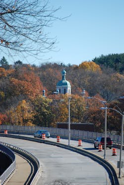
The recent redesign of a disjointed section of the Arborway through Boston’s Forest Hills/Jamaica Plain neighborhoods became a transformative endeavor, as an army of designers, consultants, government agencies and stakeholder groups worked for months to strike a balance between livability and mobility concerns.
Not since the nationally renowned “Big Dig” in Boston has the Massachusetts Department of Transportation undertaken such a multifaceted, complex planning and engineering task. Due to the project’s multimodal components, overlapping state and local jurisdictions and the historic status of the Arborway itself, multiple government agencies became involved, including the Massachusetts Bay Transportation Authority (MBTA), Department of Conservation and Recreation (DCR) and the city of Boston. Each one of these participants brought its own unique perspective and challenges to the project.
At question was whether the structurally deficient 1951 William J. Casey Overpass would be replaced with another viaduct or transformed into an at-grade continuation of the Arborway.
HNTB joined the project team early in the process as lead for both planning and design and worked with MassDOT to evaluate the various options. Arriving at the decision was not easy, as arguments for both sides were credible in their own right. Ultimately, through months of planning and negotiation with more than 30 different community groups, MassDOT chose to replace the bridge with an at-grade parkway.
While cost was an important factor, it was not the primary reason behind the decision and only one element of many weighed in making what the project team came to call the “at-grade decision.” Michael Trepanier, assistant project manager with MassDOT, said his department felt bringing the road to grade was the “best match to the wishes the community had expressed to us,” as it would reconnect the Emerald Necklace, a historic linear green space, which begins at the Public Garden in downtown Boston and connects a series of historic parks to Franklin Park on the border of Jamaica Plain and Dorchester.
The linear park system was originally envisioned by Frederick Law Olmsted, long considered the father of American landscape architecture. The current project, at a little less than a mile long, will reconnect Boston’s Franklin Park and Arnold Arboretum with a tree-lined boulevard and pedestrian and bicycle paths that honor the vision of what Olmsted created in the 1800s without being a slavish copy of it.
The decision represents a significant paradigm shift at MassDOT but follows the agency’s goals of promoting and establishing healthy and green transportation options. Reconnecting the Emerald Necklace by replacing the overpass with a boulevard represents a departure from the engineering tradition of the past 50 years—moving as many cars as quickly as possible—and will vastly improve accommodations for both pedestrians and bicycles alike. Still, the HNTB team and MassDOT incorporated elements into the design to maintain adequate vehicular capacity. For example, an innovative “bow-tie” design will process east-west left-turn movements as right turns at the major intersections, thus providing additional time for vehicles, pedestrians and bicycles.
“MassDOT began with the goal of replacing a structurally deficient bridge, but with input from the community there wound up being perhaps a dozen different purposes embedded in this project.” Trepanier said. “Through working with Jamaica Plain residents and integrating their vision for their neighborhood, we came to see this as an opportunity to provide significant benefits to the community. The balance struck between livability and mobility and finding a balance between a spectrum of stakeholders was our greatest accomplishment here. We believe that the project will bring positive change to this area for decades to come.”
Underscoring the return of the Arborway to its historical roots as a parkway, once the viaduct is removed through Massachusetts’ Accelerated Bridge Program, the reconstructed Arborway section will be returned to the stewardship of the DCR.
Loads of modes
For HNTB and MassDOT, the multimodal components of Casey Arborway presented one of the project’s most significant challenges. At the heart of the Casey site is the MBTA’s Forest Hills Station, a multimodal center accommodating nearly 20 bus routes in three separate busways, a taxicab stand, the Orange Line subway terminus, an MBTA commuter rail station and Amtrak’s Northeast Corridor passage. Just to the north of the station is the Southwest Corridor Park Greenway, connecting the station with a bicycle path and pedestrian route to the center of Boston.
“When you look at each of the modes, there is a different responsible partner agency, each with its own constituency to serve,” Trepanier said. “That was certainly one of our greatest challenges. While these partner agencies had to be brought into the decision-making process—and their cooperation was invaluable to us—we were ultimately responsible for getting the project done.”
This meant MassDOT often had to bring together the diverging viewpoints of the partner agencies to reach consensus. For the city of Boston, there were four different subagencies involved, all with their own individual review processes; and DCR and MBTA had their own review layers. Additionally, there were landscape architects, traffic engineers, project engineers, a cultural historian and as many as 12 consultants involved in the discussions.
“We had dozens of representatives of our partner agencies and a large and highly specialized group of consultants, and each one brought their own perspectives and top priorities in every conversation,” Trepanier said. “Ensuring that everyone worked together and spoke the same language was a major effort.”
The project’s multimodal components include:
- A new full-access fare-collection head-house for the Orange Line subway access on the north side of the project. The head-house will allow users to access the Orange Line without crossing the Arborway as they currently do. The existing head-house is egress-only;
- A new upper busway deck to accommodate 11 bus routes, including one of the busiest routes on the MBTA system, Rte. 39. This new bus deck will combine two bus loading/unloading areas into one, thus improving connections for users and operations for the MBTA;
- An innovative traffic-signal design (easterly and westerly bow-tie intersections), which will restrict mainline left-turn movements at the two major intersections, thus providing additional time for vehicles, pedestrians and bicycles at the intersections to improve operation under the at-grade alternative. Pedestrian and bicycle crossing time also will be enhanced with the use of lead-pedestrian intervals (LPIs) and bicycle signals, which also increase crossing times;
- A new bicycle roundabout at the entrance to the Southwest Corridor Park, helping direct the crossing bicycle traffic and pedestrian traffic safely and efficiently; and
- The creation of an extensive pedestrian and bicycle network—nearly 3 miles of paths—through the project area along the Arborway, separate bicycle and pedestrian crosswalks at intersection locations and extensive pedestrian and bicycle wayfinding signs.
In many cases, MassDOT was forced to take ownership for design sins of the past. For example, since the relocation of the MBTA Orange Line head-house was considered a betterment valued at more than 35% of the facility’s cost, Massachusetts law dictated that a full evaluation of the entire station’s deficiencies be conducted. Subsequently, the cost for the MBTA improvements grew dramatically, and by project’s end the station work accounted for a substantial portion of the overall Casey Arborway project cost.
“Early in the process, back as far as some of the earliest meetings in 2011, the community came to us and made it clear that access to transit was of great importance. We realized that relocating the head-house and making it an entrance and exit would significantly address that goal. That said, when we added it to the project, we did not fully realize the magnitude of what committing to that improvement would mean for us. Nonetheless we stuck with it, because we knew what it meant to the residents of Jamaica Plain,” Trepanier said. MassDOT hired consultants to locate the deficiencies, some of which included:
- The grade of the platform did not meet requirements;
- There was one elevator to the commuter rail platform but not a second accessible egress;
- The commuter rail platform had surface cracks; and
- The bathroom did not meet accessibility requirements.
Another multimodal component called for an expanded and enhanced network of pedestrian and bicycle paths. Designers were tasked with determining the best options for dealing with these components at intersections, while seeking to accommodate the needs of various advocacy groups. In one significant compromise, bike lanes were eliminated from the roadway shoulder, while the parallel off-street bike paths were placed on both sides of the roadway and set at a robust 12 ft wide. This reduced road width by 6 ft and reduced the overall crossing distance for pedestrians. Dedicated crossings and ramps were added to keep the bike paths and pedestrian paths separate at every intersection, minimizing mode conflicts.
“Here we were taking down a structurally deficient bridge, and at the same time we were resolving some neighborhood issues that had been an ongoing problem,” Trepanier said. “In one instance, we dedicated a space in the MBTA parking lot for school buses to drop off and pick up. Before, they were stopping in multiple locations and creating a significant impediment to traffic flow.”
In another example, the MBTA busway was reduced from three to two bays to allow room for a vegetated area to serve as a pedestrian and visual barrier.
Throughout the process, Trepanier and the MassDOT representatives, as well as HNTB’s lead designer Jonathan Kapust, gathered constructive input from the project’s Design Advisory Group (comprising neighborhood representatives and various advocacy groups). Design decisions were shared and discussed at regularly held meetings, encouraging community involvement. Virtually every corner of the design includes a component that was the direct result of the advisory group’s input.
Accelerated deadline
The project must be completed by Sept. 30, 2016, in order to qualify for funding by the state’s Accelerated Bridge Program. Therefore, there are significant incentives built into the contract for the project to be completed and operational by the deadline.
The contract for the $62 million Casey Arborway project will be awarded this fall and will include a provision for the contractor to maintain the existing bridge through the winter months. Following three months of temporary roadway construction to the north of the bridge, demolition of the existing 1,650-ft-long bridge will begin.
The new 3⁄4-mile boulevard will feature two 11-ft lanes of bituminous pavement in each direction separated by a tree-lined median. At the major intersections, the roadway will be increased to three lanes to allow for the innovative bow-tie design. The road will accommodate as many as 35,000 vehicles per day.
The roadway has very delicate horizontal and vertical curvatures, as designers accommodated existing constraints and obstacles. The vertical curvature was necessary due to the existing train tunnel and to accommodate pedestrian ramps to meet Americans with Disabilities Act requirements. The result of these alignments will produce a roadway that matches the existing Arborway to the west, which was designed by Olmstead.
Equally delicate is the drainage system. Underground infiltration systems will be added to ensure the site drains properly. The roadway alignments, drainage and other underground utilities—including three 48-in. water mains—were carefully balanced to minimize reconstruction.
Forever different
The experiences gained from the Casey Arborway project will forever change the way MassDOT approaches multimodal and highway-only projects alike. The level of public involvement and engagement has been unprecedented. Many in the department gained invaluable experience in collaborating and working with both the public at large and various government agencies, as projects more often span the spectrum of highway, transit and recreation.
“The fact that we did what we did on the project has already cleared the way for significant changes within the department,” Trepanier said. “The fact that the agency was willing to even consider a loss in capacity—though we ultimately did maintain it through the bow ties—in favor of livability concerns is deeply meaningful. It’s now in the mentality of the typical MassDOT employee that we did some awesome things in Forest Hills.” R&B