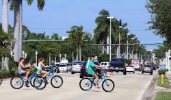
When the Florida Department of Transportation expanded S.R. 45 and S.R.90 to six-lane arterials in 1982, against the objections of the city of Naples, the effect created what locals referred to as “the Great Divide.” Increased traffic volumes resulted in a disconnect between neighborhoods and businesses; on-street parking was largely eliminated; sidewalks were drastically narrowed while crosswalks were lengthened; and bicyclists were shunned in favor of traditional vehicle and truck traffic.
Since the expansion, the city has conducted traffic studies which have concluded that while traffic volumes do reach limit of service during peak times, it is largely due to intersection operations. Modification to improve the intersections and divert regional trips to alternate routes would provide the opportunity to consider a lane diet on U.S. 41. Consequently, locals want a better concept for multimodal transportation opportunities and complete street concepts within the existing right-of-way.
The city of Naples embarked on a Downtown Mobility & Connectivity Study in June 2016 with the purpose of transforming transportation infrastructure so that it supports the existing and future health and prosperity of the community. Naples enjoys affluence not afforded by many communities. The high quality of life comes from a well-orchestrated system of land use, transportation, and services requiring active contributions from all walks of life.
The recommendations from the study also are intended to expand prosperity into the redevelopment areas of downtown for the benefit of existing and future residents, guests, and visitors. Study recommendations will shift the transportation network from car-centric operation to multimodal choices that are safe and convenient through enhanced mobility and connectivity.
The study was inclusive of other planning processes, studies and design in infrastructure; traffic operations management; policy re-writes; wayfinding; land development; and park construction.
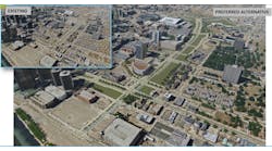
An important consideration of the study was to address all modes of mobility for people—from the personal automobile to walking, biking, or riding transit. The study was organized to develop and evaluate alternatives that seek to mitigate the existing operational challenges while providing an improved future condition, including an assessment of existing peak season conditions and a comparison to potential 2040 No Build, Base Build, and Enhanced Build alternatives in transportation infrastructure and corresponding operations. These were developed with input from the public and other project stakeholders while avoiding or minimizing impacts to the surrounding social, natural and physical environment.
Involving the community
An Alternatives Development and Review Team (ADRT) was organized to provide feedback throughout the process. Multiple city council briefings were provided by study participants.
Comments received from the public and project stakeholders (summarized on page 30) were delivered to the study team continuously during the analytical phase of the study. This collaboration and sharing of information was the method used to develop the most comprehensive results possible to serve all those using the transportation network.
Key elements of the project coordination and public outreach strategy included local/state agency coordination meetings, business/neighborhood group meetings, project review meetings, ADRT meetings, a three-day design charrette, and various informational materials.
Mobility improvements
Following extensive data collection, evaluation, and review of existing conditions, significant opportunities for improved mobility and connectivity emerged. Most notably, bicycle and pedestrian improvements in the study area to close existing gaps at a basic level, and to provide premium facilities at a more advanced level, yielding additional transportation options and substantially improving the user experience. Future land-use policies that promote the mixing of land uses and greater concentration of employment within the study area also provide an opportunity for more walking and biking. Currently, the roadway network is operating relatively well much of the year, and the grid pattern of the network affords the city the opportunity to redistribute traffic from major thoroughfares to parallel facilities with available capacity. This opportunity allows the city to consider alternatives that retrofit the existing auto-centric roadways within the study area to accommodate all modes of travel within the existing right-of-way.
With this understanding of existing opportunities in mind, supplemented by input from the public and stakeholders, the study team developed a menu of alternative improvements that were evaluated as part of this study.
Findings and recommendations
A complete streets philosophy, it was determined, would place safety at the forefront within the transportation network design. A high level of effort was focused on incorporating proven design techniques to encourage safe behavior by pedestrians, cyclists, and drivers when they are in their own space and wherever there is a point of potential conflict. The idea that “a roadway safe for a pedestrian is safe for everyone” was at the forefront of all improvement recommendations, including:
- Design speed;
- Roadway and lane width;
- Sight distance;
- Curb radii;
- Lighting;
- Landscape buffers; and
- Midblock pedestrian crossings.
Two final network alternatives were developed and formed the Base Build and Enhanced Build pedestrian systems. Both alternatives identify key locations for improvements to connect the community, close the gaps in the existing system and correct ADA deficiencies. The differences from the Base Build and the Enhanced Build alternative networks include expanded sidewalks on certain key roadways, more extensive separated bicycle facilities, and additional optional improvements on selected facilities. The final selection of the various alternative recommendations was determined by the Naples City Council through coordination with the Florida Department of Transportation (FDOT) and Collier County. FDOT is currently in the process of evaluating what selected urban design improvements can be incorporated into planned reconstruction for portions of U.S. 41 in Naples.
Implementation strategies
Although a great deal of focus was placed on enhancing the pedestrian and bicycle network, a truly balanced, multimodal transportation system must also serve vehicular traffic with equal emphasis. Fortunately, Naples has a strong roadway network grid system to serve land-use access as well as the mobility needs of motorists travelling within the study area. The grid allows for traffic to dissipate throughout the network versus being funneled to only a few routes and intersections.
Some techniques implemented to improve operations in the network or enhance conditions for other modes with limited impact to the automobile level of service included:
- Modification to access/turn restrictions;
- Optimized lane configuration;
- Modified traffic signal phasing and timings; and
- Lane elimination or redesignation.
In evaluating the performance of traffic operations in the study area, several macro-level network and corridor performance measures were consulted: the average network travel time per vehicle, the average network delay per vehicle, the average number of stops per vehicle, the average network speed, and the average travel times on U.S. 41 for the full extent of the study area.
Table 1 reflects the findings of the comparative mobility plan analysis. Travel times are only moderately impacted by the U.S. 41 lane reduction that was evaluated, and the benefits to the pedestrian and bicycle systems reduced potential for crashes due to speed reduction and the opportunity to incorporate improved transit facilities using the area created by the lane reduction.
A blended plan
The implementation plan blends the two build alternatives (Base and Enhanced) where certain high-level bicycle facilities are replaced with buffered bike lanes consistent with the recommendation from the ADRT and some city staff. The consideration of the “cycle track” options could be reevaluated when this facility type is more widely acknowledged by users in the region. Additionally, the potential for a roundabout at one of the primary intersections on the U.S. 41 arterial was not proposed for immediate implementation as there were some possible conflicts with traffic entering the intersection that would result in a possible increase in minor crashes due to spacing considerations. The remainder of the Enhanced Build Alternative was retained in the development of the implementation plan.
Each of the alternative concepts for each corridor were developed in a holistic manner, with a consideration given to how plans for one mode of transportation impacts or enhances the others. For instance, the incorporation of on-street parking has a negative impact on the safety and comfort of cyclists. This is due to the increased chance of door-swing conflicts. Conversely, the presence of on-street parking enhances safety and comfortability for pedestrians because the parked vehicles act as a physical barrier between pedestrians and motorized vehicles.
The development of the alternative concepts also considered adjacent land uses and how the transportation system could best support these land uses. Where possible, given right-of-way constraints and the needs of other modes, wider sidewalks and on-street parking was provided near commercial land uses to enhance the vibrancy and economic well-being of the community’s businesses.
Ultimately, considering these factors, among others, typical sections were developed for the recommendations on major study area corridors. These typical sections, which are constrained to current right-of-way, aim to balance the sometimes-competing needs of transportation modes and adjacent land uses. Finally, the City Council did choose not to support the lane reduction on U.S. 41 but to advance other improvements that would have some positive impact on the alternative modes using that corridor.


