There are stretches along the Mississippi River that to this day have seen limited human intervention or imposition, a remarkable fact.
One such stretch is located along the meeting of northwestern Illinois and southeastern Iowa, adjacent to U.S. Rte. 52. There the foliage is dense, and despite the existence of many communities along the riverline, getting from one state to the other has been, for many decades, a mixture of inconvenience and treacherous difficulty.
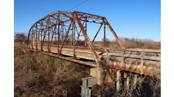
Where the towns of Savanna, Ill., and Sabula, Iowa, meet stood an 86-year-old bridge that was the only urban means of crossing the Mississippi for many miles, the next closest crossing being in Fulton, 20 miles downriver. Thus the Savanna-Sabula Bridge, built in 1932 as a private toll bridge and ceded to the state of Illinois in 1987, was a crucial means of shipping goods across state lines. It also was a commuter artery for those folks who live on one side of the river but are employed on the other.
Unfortunately, the old bridge had become as much a significant safety concern as an antiquated span incapable of providing the mobility the modern communities it served required. At just 20 ft across and featuring a tooth-grinding steel-grid deck, the bridge had no room for shoulders; it was too narrow to accommodate bicycles or disabled vehicles; and wider vehicles, such as freight trucks and even some larger SUVs, would often overlap into the oncoming lane, creating what many residents in the area characterized as a terrifying trip over the river.
“There were stories of folks who were too scared to drive over the old bridge,” Pat O’Shea, project manager for Kraemer North America, told Roads & Bridges. “They would drive down to Clinton or Fulton to get across the river. The economic impact of that was pretty significant.”
In 2010, an inspection identified 100 structural deficiencies in the bridge requiring $8 million in repairs and an eight-month full closure—this, after a $2.9 million, 28-day closure repair in 2008. With the bridge handling 2,400 vehicles per day, it became clear to both Illinois Department of Transportation (ILDOT) and Iowa Department of Transportation (IDOT) officials that it was time for something new.
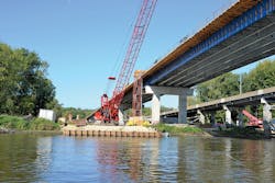
Crews set coffer cells in the river to accommodate the new piers, which retained the 508-ft marine navigation channel of the old bridge, as stipulated by the U.S. Coast Guard.
Working in a river
From the get-go, replacing the bridge was going to be a challenge. Not only was it listed on the National Register of Historic Places, it ran through a portion of a National Fish and Wildlife Refuge. As this was federally protected land, the footprint of the new construction zone would be limited. Moreover, the river navigation channel was subject to U.S. Coast Guard oversight.
A project study recommended a new bridge be built 100 ft south of the existing structure; the study limits extended 1,500 ft west of the bridge along U.S. 52 on the Iowa side to the T-intersection of S.R. 84 on the opposite side. Following a design created by Parsons, who was under contract for planning, environmental clearance and design, a construction contract was let in October 2015 to Kraemer North America.
The difficulty of working in a marine environment presented itself immediately.
“For starters, we had to perform a mussel survey in order to place our temporary dock location,” O’Shea said. “We sent divers down. Thankfully, we did not find anything to transplant. We also had what I call a ‘bat window’. Restrictions, basically, where we could only cut trees at a certain time of year, based on the patterns of Little Brown and Northern Long-Eared bats, whose habitat was adjacent to the site. Those removals, as well as the eventual demolition of the old bridge, had to be done between Oct. 1 and March 31.”
When work got underway in March 2016, Kraemer crews found themselves often surprised by what the river would allow them to do—sometimes on a day-to-day basis.
“One of the major challenges we faced was the flood potential of the river,” O’Shea said. “When we were working on the coffer dams and coffer cells, there was the danger of them flooding. So we worked task-to-task, based on water elevations. We worked on stuff that was water-conducive. When high water prevented us from working on something, we had to pick locations where we could progress while still maintaining our schedule. Elevation and flow were both challenges. There is a tremendous amount of flow. And since work took place throughout the year, the coffer cell formwork was designed to withstand ice—both ice forming around it and ice coming in from downstream.”
River depth in this area varies 25-30 ft and is underlaid by a sharply angled layer of dolomite limestone, which, as it is near the surface on the Illinois side of the river, required use of waterline foundations. The waterline footings eliminated the need for pricier cofferdams and shaved days off the construction schedule. The final river pier foundations consisted of 94-in.-diam. drilled shafts with 14-ft-deep rock sockets.
In coordination with the U.S. Coast Guard, the 508-ft navigation channel provided by the old bridge had to be maintained; however, in order for the project to qualify for federal funding, the channel had to be shifted west toward Iowa, a circumstance that afforded both challenge and opportunity, as the project design called for a tied-arch construction on the 546-ft main span.
“We did shift the navigation channel 150 ft west toward Iowa,” O’Shea recalled. “We had to do that for funding reasons and to achieve a 4% or less slope on the approaching roadway. The Illinois approach had to be flattened out, which shifted the position of the arch and thus the channel to the left. This was approved by the Coast Guard. The arch was, overall, 100 ft tall, and to construct it we used the cantilevered erection method.”
The 546-ft-long, 100-ft-high tied arch was constructed using the cantilevered erection method aided by cranes stationed on barges at the site.
Tied up
The cantilevered method proved beneficial to the project as it minimized the impact to navigable marine and boat traffic. Temporary 185-ft-tall falsework towers, owned by Kraemer, were brought in and modified at each end to facilitate the connection to the knuckle at the base of the tower and the heads at the top for the temporary stays. All erection was performed between tugboats, so as not to impede upstream/downstream traffic. Dawes Rigging & Crane was brought onto the project and used a 350-ton Manitowoc MLC300 crawler crane to lift the span and arch girders. As all steel on the project was trucked in rather than shipped down on the water, it was important for crews to be able to readily transfer the beams safely and easily from the dock.
In total, the three span portions of the new bridge comprised two 958.5-ft outer plate girder spans and the aforementioned 546-ft-long central tied-arch span, which has ties spaced at approximately 48 ft across its entire width. Web-plate girder length ranges from 54 in. and 84 in. on the Iowa approach to 78 in. on the Illinois approach. The spans consist of a six-girder layout with girders spaced at 7.25 ft. The use of six girders will allow for the bridge deck to be replaced one-half at a time, while bi-directional traffic is maintained during any and all maintenance and repair operations. Overall, the new structure features two 12-ft driving lanes, each with 8-ft shoulders.
Double pours
With the bridge running over a protected waterway, concrete deck pours were another challenge. Consequently, crews devised a dual-pour system that allowed the main arch span to be addressed efficiently and with minimal risk to the underlying river.
“When we poured the deck of the 546-ft tied-arch portion, we used two Bid-Wells with two backout conveyor systems,” O’Shea said. “We had to pour continuously from the center, call it the 270-ft mark, and work our way back out to 546 on either side. We could not have the pour be one floor beam out, so you’re evenly loading that tied arch. We used the backout conveyor system, split the system in half, put two super-swingers on it, and poured from the center out in each direction. Our subcontractor M&M Concrete laid 600 yd on that main span over one weekend in Sept.-Oct. 2017.”
A standard SI DOT mix was employed at 8 in. thick, with fly ash and Superpave. A seven-day wet cure with single-use, cotton-mat permeable plastic finished it off. Compressive strength requirements for the substructure were 3,500 psi and for the deck 4,000 psi, both of which were achieved.
In total check
Fehr Graham was hired to provide surveying analytics to the project. The firm employed auto-surveying techniques which were a first for a bridge built in the Midwest.
“The system we used is normally used in quarries, where land will move, or in building construction where you have seismic shifts,” Scott Immel, land surveyor and survey manager for Fehr Graham, told Roads & Bridges. “Prisms on the tied arch in tension areas were determined to be appropriate for monitoring. We placed two robots on the Illinois side near the abutment. When the system is running, we’re able to know in real-time precisely where the elements of the bridge are at (spacially).”
The robots are called total stations. Total stations are a horizontal and vertical scope that offers an angle with horizontal and vertical reference and also monitors distance, which gives a 3-D measurement of an object or point. The robotic portion uses Bluetooth radios which can control the movement from either a handheld collector or a computer. It is mounted in a fixed location but rather than physically altering or manipulating it, it can be controlled remotely.
“The software portion was hosted on a cloud-based system with access pretty much anywhere,” Immel said. “So there was a digital appliance piece connected to the physical robotic total station that then connected to the cloud service system, generating data and allowing for control of the station unit. We could provide to Kraemer and ILDOT real-time measurement of the position/location of the prisms installed on the arch structure, in order to calculate the geometry of the arch as they were building, to make sure it was, basically, where it belonged as they put it together. Until the last piece of the arch goes in, the structure is constantly moving. Not a lot, but it is moving. Differences happen due to wind and temperature alterations.”
The use of the total stations and cloud monitoring translated—much as the cantilevered erection method on the arch span did—into cost savings, as it precluded the need for a worker to physically monitor all 50 prisms on the bridge.
Quite a memorial
The new Dale Gardner Veterans Memorial Bridge opened to traffic on Nov. 17, 2017; its temporary traffic lights were removed shortly thereafter, on Dec. 1. The $80.6 million project came in precisely on schedule and has already been recognized as a boon to the communities of Savanna and Sabula.
“This bridge will bring new economic opportunities to both our communities,” Savanna Mayor Chris Lain stated at the bridge’s grand opening ceremony. “We hope to see an increase in commercial traffic as well as tourism.”
Now that the old bridge has been demolished and its remnants taken away, the new bridge offers a stunning reinvention of this stretch of the Mississippi River, one that blends the new and prosperous with the timeless and unchanging. A combination of communities that also is a marriage of present and past.
------------
Roads & Bridges is grateful to Anna Derocher for contributing photos of this project.


